


A new development in Washington, D.C. features the largest "shared space" in the United States.
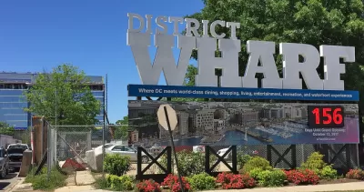
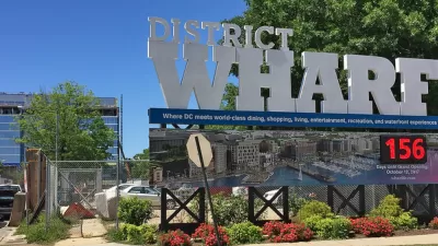
The Wharf, a new mixed-use development in southwest Washington, D.C., features a "shared street." At 60 feet wide and several blocks long, the right-of-way is carefully designed to allow vehicular traffic while favoring pedestrians. Although the development has only been open for a short time, the street is performing as expected.
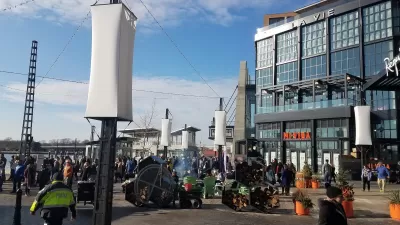
Designed by Stan Eckstut of Ehrenkrantz Eckstut & Kuhn, the street is carefully calibrated to be pedestrian-friendly first and foremost. Vehicles are somewhat restricted thought not forbidden. A benefit of little traffic on Wharf Street is it allows for truck deliveries,
Wharf Street includes an array of street furniture, granite bollards, stripes of pavement and other design features visibly make the pedestrian at home and discourage vehicle speed. The street is even served by a cycletrack.
Even alleys that branch off Wharf Street are pedestrian-friendly. Blair Alley runs between an apartment building and an office building and provides truck docks for both buildings. Nearby Water Street acts as an alley, even hosting a scattering of shops. And like Blair Alley, Water Street provides a meaningful pedestrian connection to the waterfront.
FULL STORY: A Radical Mixing of Cars and People Works as Planned

Designing for Dementia
Subtle design interventions can facilitate safe navigation in urban environments for people with cognitive abilities effected by dementia.
Has Washington, D.C. Finally Figured Out the Waterfront?
Looking back to evaluate the potential of the present.
D.C.'s Wharf Makes the City's Housing Problems Worse
Did The Wharf, a new mixed use mega project in Washington, D.C., deliver enough public benefit to warrant its large public subsidy?

Planetizen Federal Action Tracker
A weekly monitor of how Trump’s orders and actions are impacting planners and planning in America.

San Francisco's School District Spent $105M To Build Affordable Housing for Teachers — And That's Just the Beginning
SFUSD joins a growing list of school districts using their land holdings to address housing affordability challenges faced by their own employees.

The Tiny, Adorable $7,000 Car Turning Japan Onto EVs
The single seat Mibot charges from a regular plug as quickly as an iPad, and is about half the price of an average EV.

With Protected Lanes, 460% More People Commute by Bike
For those needing more ammo, more data proving what we already knew is here.

In More Metros Than You’d Think, Suburbs are Now More Expensive Than the City
If you're moving to the burbs to save on square footage, data shows you should think again.

The States Losing Rural Delivery Rooms at an Alarming Pace
In some states, as few as 9% of rural hospitals still deliver babies. As a result, rising pre-term births, no adequate pre-term care and "harrowing" close calls are a growing reality.
Urban Design for Planners 1: Software Tools
This six-course series explores essential urban design concepts using open source software and equips planners with the tools they need to participate fully in the urban design process.
Planning for Universal Design
Learn the tools for implementing Universal Design in planning regulations.
Smith Gee Studio
City of Charlotte
City of Camden Redevelopment Agency
City of Astoria
Transportation Research & Education Center (TREC) at Portland State University
US High Speed Rail Association
City of Camden Redevelopment Agency
Municipality of Princeton (NJ)