


The city of Portland will take the momentous step of estimating person trips, rather than car trips, when estimating the impacts of new developments. The decision is another step toward ending the systems of car-centric planning.

Jonathan Maus reports that the Portland City Council "unanimously passed an ordinance (PDF) allowing PBOT to use a methodology that uses 'person trips' – meaning trips made not just by people in cars and trucks but also foot, by bike and in transit vehicles."
According to Maus, "the methodology Portland currently uses is based on the Institute of Transportation Engineers (ITE) Trip Generation Manual [pdf] which [Brian Davis, a transportation analyst at Lancaster Engineering] calls, 'very car-oriented.'" That methodology often greatly overestimates the number of car trips a development will generate, resulting in development fees and infrastructure costs that greatly overcompensate for the needs of cars.
The change of methodology comes against the backdrop of a larger effort by the city to restructure its Transportation System Development Charge (TSDC). According to Maus, however, the implications of the decision to measure person trips could extend even further than the TSDC, when combined with the relatively new skepticism toward level of service as a measure of impact. Maus writes: "If we begin to quantify road users as people doing a variety of things — not just driving a car — than we can start looking at a multi-modal level of service and begin planning for the city we want."
FULL STORY: Beyond cars: City Council votes for ‘person trips’ to make better planning decisions

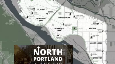
North Portland in Motion Launches with Goals to Improve Walking, Biking, and Transit
The Portland Bureau of Transportation continues its work of drafting transportation plans targeted to specific geographic corners of the city,
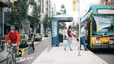
Seattle Leads the Nation in Reducing Car Ownership
Seattle has achieved unparalleled success in allowing residents the option to choose not to own a car.
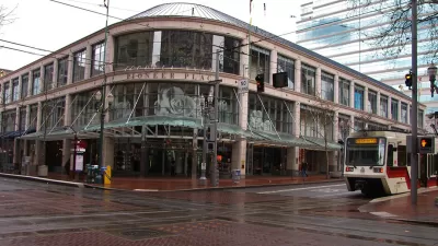
Business Community Weigh In on Portland's Downtown Multi-Modalism Plans
A potentially game-changing suite of transit and active transportation projects is under consideration in Portland. The business community has reservations, but is also strongly supportive of aspects of the plan.

Maui's Vacation Rental Debate Turns Ugly
Verbal attacks, misinformation campaigns and fistfights plague a high-stakes debate to convert thousands of vacation rentals into long-term housing.

Planetizen Federal Action Tracker
A weekly monitor of how Trump’s orders and actions are impacting planners and planning in America.

Chicago’s Ghost Rails
Just beneath the surface of the modern city lie the remnants of its expansive early 20th-century streetcar system.

Bend, Oregon Zoning Reforms Prioritize Small-Scale Housing
The city altered its zoning code to allow multi-family housing and eliminated parking mandates citywide.

Amtrak Cutting Jobs, Funding to High-Speed Rail
The agency plans to cut 10 percent of its workforce and has confirmed it will not fund new high-speed rail projects.

LA Denies Basic Services to Unhoused Residents
The city has repeatedly failed to respond to requests for trash pickup at encampment sites, and eliminated a program that provided mobile showers and toilets.
Urban Design for Planners 1: Software Tools
This six-course series explores essential urban design concepts using open source software and equips planners with the tools they need to participate fully in the urban design process.
Planning for Universal Design
Learn the tools for implementing Universal Design in planning regulations.
planning NEXT
Appalachian Highlands Housing Partners
Mpact (founded as Rail~Volution)
City of Camden Redevelopment Agency
City of Astoria
City of Portland
City of Laramie