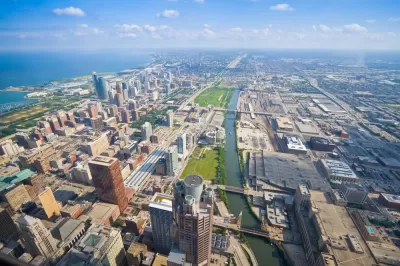
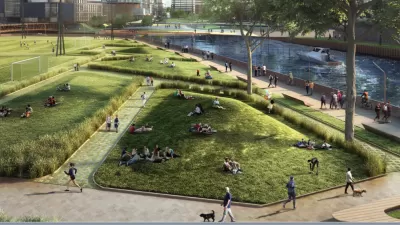
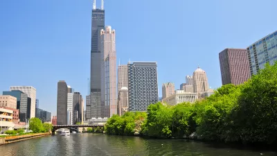
The Chicago River is attracting some of the city's most creative visions for the future. The second plan in recent months proves the potential of the river as an open space asset.

Mary Wisniewski reports on a new effort in Chicago to restore the Chicago River. The premise that opens the article: that while Chicago's lakefront is a triumph of planning as the city's frontyard, the river has suffered from long neglect.
Though Daniel Burnham included riverfront promenades in his 1909 Plan for Chicago, most of the land along the river has long been inaccessible or unappealing — a mix of scrub trees and litter, industry and private property. The river was known mainly for pollution, and the fact that it was engineered to flow backward.
Wisniewski's discussion about the Chicago River is set in the context of a new plan for a "continuous bike and pedestrian trail along the entire 27-mile Chicago riverfront by 2030." The plan by the Active Transportation Alliance aims to make the river the city's backyard.
"The ideas for new trail segments range from the more easily achievable — developers on the riverfront south of the Loop including a trail as part of their project, for example — to more complicated ideas such as putting stationary or floating docks over the water in places where it is tough to build on land," according to Wisniewski.
The Chicago River Trail plan builds on another big plan for the Chicago River announced in August. The "Our Great River" plan included a discussion of a continues trail along the river but the "Alliance's preliminary report took it a step further and supplied details about how it could work."
FULL STORY: Ambitious proposal would make Chicago River the city's new backyard

Planetizen Federal Action Tracker
A weekly monitor of how Trump’s orders and actions are impacting planners and planning in America.

Congressman Proposes Bill to Rename DC Metro “Trump Train”
The Make Autorail Great Again Act would withhold federal funding to the system until the Washington Metropolitan Area Transit Authority (WMATA), rebrands as the Washington Metropolitan Authority for Greater Access (WMAGA).

The Simple Legislative Tool Transforming Vacant Downtowns
In California, Michigan and Georgia, an easy win is bringing dollars — and delight — back to city centers.

The States Losing Rural Delivery Rooms at an Alarming Pace
In some states, as few as 9% of rural hospitals still deliver babies. As a result, rising pre-term births, no adequate pre-term care and "harrowing" close calls are a growing reality.

The Small South Asian Republic Going all in on EVs
Thanks to one simple policy change less than five years ago, 65% of new cars in this Himalayan country are now electric.

DC Backpedals on Bike Lane Protection, Swaps Barriers for Paint
Citing aesthetic concerns, the city is removing the concrete barriers and flexposts that once separated Arizona Avenue cyclists from motor vehicles.
Urban Design for Planners 1: Software Tools
This six-course series explores essential urban design concepts using open source software and equips planners with the tools they need to participate fully in the urban design process.
Planning for Universal Design
Learn the tools for implementing Universal Design in planning regulations.
Smith Gee Studio
City of Charlotte
City of Camden Redevelopment Agency
City of Astoria
Transportation Research & Education Center (TREC) at Portland State University
US High Speed Rail Association
City of Camden Redevelopment Agency
Municipality of Princeton (NJ)


