


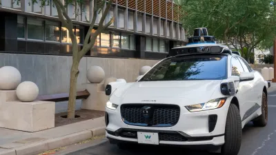
A recent report casts light on a lack of preparation by cities for the future of transportation.
Brooks Rainwater shares insights into a National League of Cities report titled City of the Future: Mobility & Technology, which "examines current transportation trends to forecast future developments in the urban environment."
Rainwater and the Tech Insider team "delved into the transportation plans from the 50 largest cities as well as the largest cities in each state" and found "a widening gap between where technology is rapidly taking us and where cities are planning to go."
For example, the report found "[o]nly 6% of cities’ transportation plans consider the potential effect of driverless technology," and "[j]ust 3% of these plans look at companies like Uber and Lyft — even though they operate in 60 of the 68 markets."
Rainwater responds by presenting four key ideas for cities to consider as they catch up to the rapidly approaching mobility technologies of the future.
- Demographic and workforce trends will impact mobility in cities
- How we pay for infrastructure will change
- Public and private mobility systems will grow in the coming years
- New modes of transportation will become available
The National League of Cities report was also included in coverage of cities' preparations for self-driving cars by Kim-Mai Cutler in November. A recent study published in the Journal of Planning Education and Research, and featured here on Planetizen, examines preparations for self-driving cars at the metropolitan planning organization level.
FULL STORY: 4 ways cities will dramatically change in the future — and how we can prepare

Is Infrastructure Ready for Autonomous Vehicles?
Assessing the readiness of current infrastructure for autonomous vehicles to understand the challenges and necessary adaptations for seamless integration in urban environments.

How “Walking Audits” Can Improve Neighborhood Mobility
A simple walk through your community can reveal infrastructure gaps and highlight where cities can make streets safer for pedestrians.
New Orleans Makes Push for Accessibility Improvements Ahead of Super Bowl
Major sporting events like the Olympics and the Super Bowl can serve as catalysts for major changes in transportation infrastructure and accessibility.

Planetizen Federal Action Tracker
A weekly monitor of how Trump’s orders and actions are impacting planners and planning in America.

Chicago’s Ghost Rails
Just beneath the surface of the modern city lie the remnants of its expansive early 20th-century streetcar system.

San Antonio and Austin are Fusing Into one Massive Megaregion
The region spanning the two central Texas cities is growing fast, posing challenges for local infrastructure and water supplies.

Since Zion's Shuttles Went Electric “The Smog is Gone”
Visitors to Zion National Park can enjoy the canyon via the nation’s first fully electric park shuttle system.

Trump Distributing DOT Safety Funds at 1/10 Rate of Biden
Funds for Safe Streets and other transportation safety and equity programs are being held up by administrative reviews and conflicts with the Trump administration’s priorities.

German Cities Subsidize Taxis for Women Amid Wave of Violence
Free or low-cost taxi rides can help women navigate cities more safely, but critics say the programs don't address the root causes of violence against women.
Urban Design for Planners 1: Software Tools
This six-course series explores essential urban design concepts using open source software and equips planners with the tools they need to participate fully in the urban design process.
Planning for Universal Design
Learn the tools for implementing Universal Design in planning regulations.
planning NEXT
Appalachian Highlands Housing Partners
Mpact (founded as Rail~Volution)
City of Camden Redevelopment Agency
City of Astoria
City of Portland
City of Laramie