


The tragedy on Livingston Avenue could have been avoided, but the city of New Brunswick's concern was with motorists—not pedestrians.
A new study finds that metro areas can reduce traffic crashes by 19 percent on busy arterial streets by imposing a road diet. A road diet reduces the number of lanes dedicated to car traffic, widening the space (and hence improving safety) for cyclists, pedestrians, and street parking. It is an antidote to the previously popular policy of widening arterial roads to accommodate increasing numbers of commuters.
"The original thinking held that wider roads meant better traffic flows, especially at rush-hour, but new lanes also attracted new traffic, and outside the peak periods you'd end up with lots of wasted road space," writes Eric Jaffe.
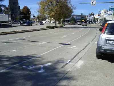
The case study is a cost-benefit analysis of Livingston Ave in New Brunswick, N.J., "an oversized arterial corridor accessing the center of the city." It comes on the heels of a traffic collision involving three students, who were seriously injured as a result. New Brunswick is home to Rutgers University, and the four-lane street has thousands of rush-hour commuters as well as many pedestrians. Drivers mostly ignore the 25 mph speed limit.
"What makes the situation in New Brunswick so much more regrettable is that city leaders knew about the safety hazards on Livingston Avenue but hesitated to change traffic patterns for fear of offending drivers," Jaffe laments.
Jaffe provides a nice graphic illustrating the simple and cheap road diet alterations proposed. According to the study, the costs are mostly political; research demonstrated that the level of service for drivers increased only modestly after a road diet. Jaffe finds: "All told, the traffic impacts amounted to two or three minutes of total delay and maybe one or two more minutes of travel time, depending on morning or evening rush hour and the precise configuration of the road diet[.]"
FULL STORY: The Benefits of Slower Traffic, Measured in Money and Lives


Rick Steves on Walkability Lessons From Europe
Many of Europe’s pedestrian-friendly, transit-rich cities weren’t always that way.
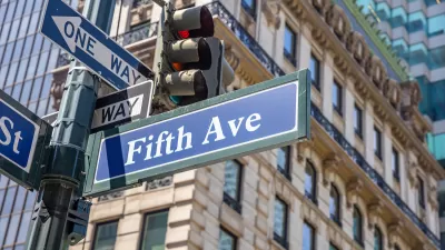
What Will Become of Fifth Avenue?
Visitors to the iconic shopping street overwhelmingly arrive by walking, transit, or bike. Why are bike and pedestrian infrastructure improvement lagging so far behind another famous NYC street, Broadway?

Car-Free Montreal Street Hailed as Success
A summer pedestrianization project is widely popular with residents and local businesses.

Planetizen Federal Action Tracker
A weekly monitor of how Trump’s orders and actions are impacting planners and planning in America.

Maui's Vacation Rental Debate Turns Ugly
Verbal attacks, misinformation campaigns and fistfights plague a high-stakes debate to convert thousands of vacation rentals into long-term housing.

Cuomo Is the Candidate of Both NIMBYs and Developers. What Gives?
In the New York City mayoral race, odd bedfellows align to preserve the housing status quo.

The Subversive Car-Free Guide to Trump's Great American Road Trip
Car-free ways to access Chicagoland’s best tourist attractions.

San Antonio and Austin are Fusing Into one Massive Megaregion
The region spanning the two central Texas cities is growing fast, posing challenges for local infrastructure and water supplies.

Charlottesville Temporarily Has No Zoning Code
A judge ordered the Virginia city to throw out its newly revised zoning code, leaving permitting for new development in legal limbo.
Urban Design for Planners 1: Software Tools
This six-course series explores essential urban design concepts using open source software and equips planners with the tools they need to participate fully in the urban design process.
Planning for Universal Design
Learn the tools for implementing Universal Design in planning regulations.
Heyer Gruel & Associates PA
JM Goldson LLC
Custer County Colorado
City of Camden Redevelopment Agency
City of Astoria
Transportation Research & Education Center (TREC) at Portland State University
Jefferson Parish Government
Camden Redevelopment Agency
City of Claremont