


America's quilt of speed limits now reaches 85 MPH in some states, with increases possible in some western states. MetricMaps has produced a visualization of the top speed limits across the country and even in detail in urban areas.
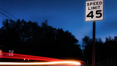
The middle swath of the United States may be considered Red States, but on MetricMaps' new visualization of nationwide speed limits, the states of the Great Plains and Rocky Mountains are a deep blue. It turns out that places that lean libertarian don't much like to place limits on drivers. Today, freedom means a speed limit of 80 MPH in many places, meaning that actual speeds are likely to be much higher.
"The Missouri River, as it turns out, is a kind of speed-limit fault line: Most states west of it consider legal what Virginia, Ohio and Illinois would call 'speeding.'"
MetricMaps has made visualizations of individual cities, displaying road networks according to their speed limits. Large areas of local streets that might be limited to 30 MPH are punctuated by arterial roads and freeways. Neutral as they are, the maps leave it to urban planners to decide how these speeds impact quality of life and safety for pedestrians and drivers alike.
"These maps, through the lens of speed limits, reflect the hierarchy of how we build roads, from local residential streets, to busier boulevards, to limited-access arterials and high-speed highways. Each environment demands different standards. But this national map also raises a question central to"vision zero" campaigns trying to end pedestrian deaths and make roads safer: Does it make sense that a residential neighborhood in Houston would allow faster traffic than a residential neighborhood in Brooklyn?"
FULL STORY: Where ‘speeding’ is legal: A map of maximum limits across the U.S.


A Map of Worldwide Speed Limits
Do you have a need for speed? Or at least a need to know the speed limit anywhere in the world? Greater Greater Washington has just the map for you.

Interactive Map Reveals America's “Shade Deserts”
Launched by UCLA and American Forests to combat heat-related deaths, the tool maps the shade infrastructure for over 360 U.S. cities.
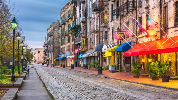
Savannah Reduces Speed Limits on Almost 100 City Streets
The historic Georgia city is lowering speed limits in an effort to reduce road fatalities.

Maui's Vacation Rental Debate Turns Ugly
Verbal attacks, misinformation campaigns and fistfights plague a high-stakes debate to convert thousands of vacation rentals into long-term housing.

Planetizen Federal Action Tracker
A weekly monitor of how Trump’s orders and actions are impacting planners and planning in America.

In Urban Planning, AI Prompting Could be the New Design Thinking
Creativity has long been key to great urban design. What if we see AI as our new creative partner?

King County Supportive Housing Program Offers Hope for Unhoused Residents
The county is taking a ‘Housing First’ approach that prioritizes getting people into housing, then offering wraparound supportive services.

Researchers Use AI to Get Clearer Picture of US Housing
Analysts are using artificial intelligence to supercharge their research by allowing them to comb through data faster. Though these AI tools can be error prone, they save time and housing researchers are optimistic about the future.

Making Shared Micromobility More Inclusive
Cities and shared mobility system operators can do more to include people with disabilities in planning and operations, per a new report.
Urban Design for Planners 1: Software Tools
This six-course series explores essential urban design concepts using open source software and equips planners with the tools they need to participate fully in the urban design process.
Planning for Universal Design
Learn the tools for implementing Universal Design in planning regulations.
planning NEXT
Appalachian Highlands Housing Partners
Mpact (founded as Rail~Volution)
City of Camden Redevelopment Agency
City of Astoria
City of Portland
City of Laramie