A series of maps from The Washington Post answers the questions of how and where the United States gets its energy.


A set of large, illustrative graphics by John Muyskens, Dan Keating and Samuel Granados, follow the big news from earlier this week about the Obama Administration's Clean Power Plan.
The first, most colorful of the graphics is a large map showing the location and scale of power generation facilities around the country. A graph showing the power portfolio for each state follows the map, and then a series of maps focusing on the different varieties of power generation.
So the maps show the dominance of coal in the Midwest and Appalachia, as well as the ubiquity of natural gas, among other trends in energy capacity from around the country. Each of the maps includes a little explainer text to help make sense of the information.
FULL STORY: Mapping how the United States generates its electricity

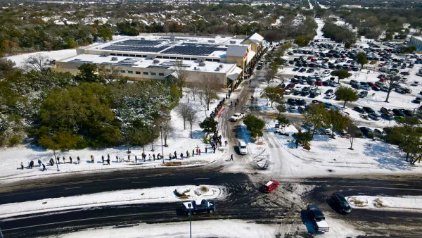
Blaming ERCOT
The Electric Reliability Council of Texas (ERCOT), the nonprofit, independent power grid operator for 90 percent of the nation's second-largest state, has become the convenient fall guy for the epic power failure caused by an extreme weather event.
Green Hydrogen, Plus Storage, Key to Los Angeles' Plan for Carbon-Free Electricity
The Los Angeles municipal utility will convert a Utah coal power plant to run on natural gas in 2025. According to a proposal unveiled Dec. 10, the plant will incrementally be converted to run entirely on hydrogen, a zero-emission fuel, by 2045.
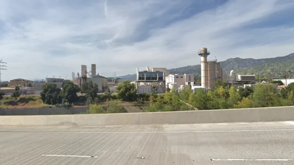
Repowered Southern California Natural Gas Power Plant Will Have Lots of Green
Most of the aging 350-megawatt Grayson Power Plant, operated by Glendale Water & Power, will be retired by 2021. The city's utility district has struggled with how to repower it. A compromise reached last month ensures low emissions and reliability.

The state-sanctioned urbicide of Austin
People don’t kill cities. Freeways do.

US to reduce Colorado River water deliveries to Mexico
A new Colorado Treaty amendment reduces Mexico’s Colorado River water allocation by 250,000 acre feet.

New Jersey’s second-largest city bans standalone data centers
Jersey City will continue to allow co-location facilities, such as those meant for research institutions that store their own data.

Amtrak not solely to blame for New Jersey commuter rail's unreliability, report finds
A new study from the Garden State Initiative found that NJ Transit’s budget grew 20% across a 4 year period, but reliability declined significantly over the same period.

EPA erases limits on planet-warming pollution from power plants
Under Monday’s plan, power plants would still have some limits on how much mercury, arsenic and other contaminants they can emit.

Phoenix announces new on-demand transit service, more frequent RAPID buses
Both new services will launch in October, and are part of Phoenix's Project Effective Access Solutions for Easing Congestion.

FREE Course: Walkable City 1: Why Walkability?
After describing his path towards focusing on walkability as the essence of good planning, Jeff Speck marches through his five principal reasons for making more walkable places.
Reinventing Malls: Planning Alchemy—Turning Gray Fields Into Gold
The course focuses on the opportunities and imperatives that shape reinvention of mall sites.

Eagle County Government
Harvard University Graduate School of Design
Nashville Planning Department
The Architects Foundation
University of Cincinnati Online
The Pocatello Development Authority
The Urban Renewal Agency of the City of Pocatello
Journal of the American Planning Association