


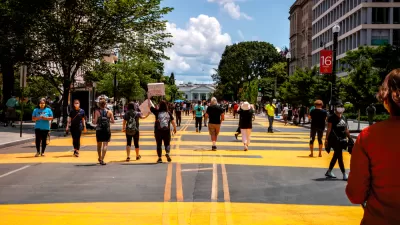
Route Fifty created a ranking system to judge the "gravitas" of each of the avenues in the nation's capital named after the 50 states in the Union.
Michael Grass describes the idea behind a recent exercise in evaluating the streets of Washington D.C.:
"What if you could rank the 50 states based on the location and characteristics of their corresponding state-named avenue in the District of Columbia? Essentially, this would be a measure of state identity gravitas—if that is something that could be indeed measured."
It's no secret that some state avenues intersect with some wildly attractive real estate—but they can't all front the White House, can they Pennsylvania Avenue? Here are the metrics that contributed to the ranking:
- How many quadrants does the state avenue pass through?
- Is the state an "Original 13" colony?
- Is the state-named thoroughfare in the original L’Enfant-designed city?
- Does the state avenue radiate from the White House or U.S. Capitol building?
- How many important junctions—traffic circles, squares and other potentially monumental intersections—does the state avenue connect?
- How many intersections are there with other state-named thoroughfares?
- Is the state-named thoroughfare physically interrupted?
- Is the state-named thoroughfare not technically an Avenue?
- Does the state-named thoroughfare cross the state line into Maryland and retain its name?
- What is the state-named thoroughfare’s length in miles?
After running all of the avenues through the methodology, Grass determines that the state at the top fo the list is Massachusetts, followed by Pennsylvania and Connecticut. Bringing up the rear is one of the state-named public right of ways that didn't warrant the title "Avenue": California.
Given California's position at the very, very bottom of the list, Grass begins the article with some discussion about whether a state of such prominence as California is worthy of an Avenue more reflective of its contributions to the Union.
Hat tip to David Alpert at Greater Greater Washington for sharing the news about the ranking.
FULL STORY: How Do the 50 States Stack Up According to Their ‘State Avenue Gravitas’ in D.C.?


Friday Fun: Ceci N’est Pas une Rue
When allowing a crowd to decide the name of something important, make sure to add a layer of self-control.
D.C. Revamps its Vision Zero Plan to Eliminate Traffic Fatalities
Washington, D.C. was an early adopter of Vision Zero in the United States, but eventually it became emblematic of the country's lack of progress in reducing traffic collisions.
D.C. Region Sets Goal to Reduce GHG Emissions From Transportation 50% by 2030
Transportation is the largest source of greenhouse gas emissions in the D.C. region—and the rest of the country. The D.C. region is committing to drastic actions to change their ways, however.

Maui's Vacation Rental Debate Turns Ugly
Verbal attacks, misinformation campaigns and fistfights plague a high-stakes debate to convert thousands of vacation rentals into long-term housing.

Planetizen Federal Action Tracker
A weekly monitor of how Trump’s orders and actions are impacting planners and planning in America.

San Francisco Suspends Traffic Calming Amidst Record Deaths
Citing “a challenging fiscal landscape,” the city will cease the program on the heels of 42 traffic deaths, including 24 pedestrians.

Defunct Pittsburgh Power Plant to Become Residential Tower
A decommissioned steam heat plant will be redeveloped into almost 100 affordable housing units.

Trump Prompts Restructuring of Transportation Research Board in “Unprecedented Overreach”
The TRB has eliminated more than half of its committees including those focused on climate, equity, and cities.

Amtrak Rolls Out New Orleans to Alabama “Mardi Gras” Train
The new service will operate morning and evening departures between Mobile and New Orleans.
Urban Design for Planners 1: Software Tools
This six-course series explores essential urban design concepts using open source software and equips planners with the tools they need to participate fully in the urban design process.
Planning for Universal Design
Learn the tools for implementing Universal Design in planning regulations.
Heyer Gruel & Associates PA
JM Goldson LLC
Custer County Colorado
City of Camden Redevelopment Agency
City of Astoria
Transportation Research & Education Center (TREC) at Portland State University
Jefferson Parish Government
Camden Redevelopment Agency
City of Claremont