


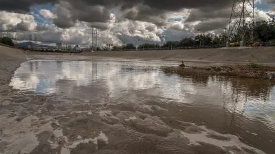
The last great U.S. wilderness won't forever remain the frozen tundra imagined by residents of the Lower 48. A new report finds evidence of Alaska's transformation in the increasing frequency and intensity of wildfires around the state.
"Alaska, the great northern frontier of America, is being reshaped by climate change," according to a post by Climate Central. "While rising temperatures are altering its character and landscape, they are also bringing the ravages of wildfires."
"In the past 60 years, Alaska has warmed more than twice as fast as the rest of the country, with average temperatures up by nearly 3°F. By 2050, temperatures are projected to climb an additional 2-4 degrees, with the Arctic region seeing the most dramatic increases. These rising temperatures are expected to increase wildfire risks in Alaska, just as they have in the rest of the western U.S."
The post serves as introduction to a full research report titled The Age of Alaskan Wildfires [pdf], which is the latest in a series of reports on the same theme. The post also shares several key findings from the current report, including specific details about the increasing size and number of wildfires in Alaska.
FULL STORY: Alaska Entering New Era for Wildfires

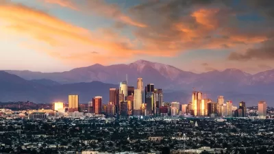
From Planning to Action: How LA County Is Rethinking Climate Resilience
Chief Sustainability Officer Rita Kampalath outlines the County’s shift from planning to implementation in its climate resilience efforts, emphasizing cross-departmental coordination, updated recovery strategies, and the need for flexible funding.
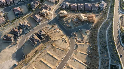
Report Outlines Strategies for Resilient Wildfire Recovery in LA
Project Recovery offers a roadmap for rebuilding more sustainable and climate-resilient communities after wildfires and other disasters.
Building Resilient Communities: Insights from the LA County Cities Summit
The Los Angeles County Cities Summit convened local leaders to share strategies for advancing sustainability, addressing climate resilience, extreme heat, and other pressing environmental challenges through policy and community-driven solutions.

Maui's Vacation Rental Debate Turns Ugly
Verbal attacks, misinformation campaigns and fistfights plague a high-stakes debate to convert thousands of vacation rentals into long-term housing.

Planetizen Federal Action Tracker
A weekly monitor of how Trump’s orders and actions are impacting planners and planning in America.

In Urban Planning, AI Prompting Could be the New Design Thinking
Creativity has long been key to great urban design. What if we see AI as our new creative partner?

Portland Raises Parking Fees to Pay for Street Maintenance
The city is struggling to bridge a massive budget gap at the Bureau of Transportation, which largely depleted its reserves during the Civd-19 pandemic.

Spokane Mayor Introduces Housing Reforms Package
Mayor Lisa Brown’s proposals include deferring or waiving some development fees to encourage more affordable housing development.

Houston Mayor Kills Another Bike Lane
The mayor rejected a proposed bike lane in the Montrose district in keeping with his pledge to maintain car lanes.
Urban Design for Planners 1: Software Tools
This six-course series explores essential urban design concepts using open source software and equips planners with the tools they need to participate fully in the urban design process.
Planning for Universal Design
Learn the tools for implementing Universal Design in planning regulations.
Gallatin County Department of Planning & Community Development
Heyer Gruel & Associates PA
JM Goldson LLC
City of Camden Redevelopment Agency
City of Astoria
Transportation Research & Education Center (TREC) at Portland State University
Jefferson Parish Government
Camden Redevelopment Agency
City of Claremont