


Imagine the kind of infill housing developments that could follow if Minneapolis approves a proposed ordinance to reduce and eliminate parking requirements for transit-adjacent developments all over the city.
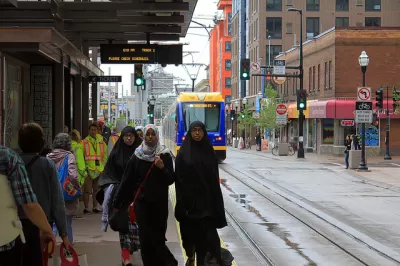
Nick Magrino details the context and reasoning behind a proposal in Minneapolis that would reduce and eliminate minimum parking requirements [pdf] for residential developments along bus and rail transit lines.
According to Margino, the "proposal would eliminate all minimum off-street parking requirements for residential developments very close to high-frequency transit stops."
More specifically:
- Parking requirements would be eliminated for residential units constructed within 350 feet of a bus or rail transit stop.
- At a second-tier of parking requirements, residential buildings built within one-quarter mile of bus or rail stops with midday service and 15 minute headways would have two requirements. Building with 3-50 units would have no required parking, and buildings of greater than 50 units would require one space per two units.
- A third tier of parking requirements would allow a 10 percent reduction of parking requirements (from a previous 1:1 parking to unit ration) for residential buildings of any size within 350 feet of bus or rail transit stops with 15- to 30-minute headways.
The article includes tables and a map to make the new parking requirements a little easier to digest.
Margino also notes that most of Downtown Minneapolis has been without minimum parking requirements for residential developments since 2009, though few developers have taken advantage of the ordinance yet. If adopted, however, the new requirement would open up new infill opportunities all over the city. Without the constraints of high land costs in Downtown, Margino speculates that more housing typologies of the "missing middle" variety (e.g., courtyard apartments, bungalow courts, townhouses, and live/work lofts) could become feasible.
FULL STORY: Minneapolis Proposes to Eliminate Minimum Parking Requirements Near Transit


Parking Reform is Sweeping the Country. Does it Work?
A new study shows a significant reduction in housing construction costs in cities that have reduced or eliminated minimum parking requirements.

Twin Cities Parking Reform Shows Promising Results
Minneapolis and St. Paul both eliminated parking minimums, paving the way for less parking and more housing.

Minneapolis Housing Plan a Success—Not for the Reason You Think
Housing advocates praise the city’s move to eliminate single-family zoning by legalizing triplexes on single-family lots, but that isn’t why housing construction is growing.

Maui's Vacation Rental Debate Turns Ugly
Verbal attacks, misinformation campaigns and fistfights plague a high-stakes debate to convert thousands of vacation rentals into long-term housing.

Planetizen Federal Action Tracker
A weekly monitor of how Trump’s orders and actions are impacting planners and planning in America.

In Urban Planning, AI Prompting Could be the New Design Thinking
Creativity has long been key to great urban design. What if we see AI as our new creative partner?

King County Supportive Housing Program Offers Hope for Unhoused Residents
The county is taking a ‘Housing First’ approach that prioritizes getting people into housing, then offering wraparound supportive services.

Researchers Use AI to Get Clearer Picture of US Housing
Analysts are using artificial intelligence to supercharge their research by allowing them to comb through data faster. Though these AI tools can be error prone, they save time and housing researchers are optimistic about the future.

Making Shared Micromobility More Inclusive
Cities and shared mobility system operators can do more to include people with disabilities in planning and operations, per a new report.
Urban Design for Planners 1: Software Tools
This six-course series explores essential urban design concepts using open source software and equips planners with the tools they need to participate fully in the urban design process.
Planning for Universal Design
Learn the tools for implementing Universal Design in planning regulations.
planning NEXT
Appalachian Highlands Housing Partners
Mpact (founded as Rail~Volution)
City of Camden Redevelopment Agency
City of Astoria
City of Portland
City of Laramie