


Penn IUR Co-Directors Genie Birch and Susan Wachter write about the promise of geospatial technologies in promoting sustainable urbanization.
That the earth's landscape is changing around us is no secret: urban areas are expanding, population densities are increasing, and green spaces are shrinking. In the midst of this transformation, urbanists, scientists, and policy makers are watching and weighing in, hoping that through better understanding of the dynamics of urbanization and sustainability, the earth can adapt, accommodate, and—yes—even thrive as the global population nears an anticipated 9 billion or more in the next three decades.
The good news is that we now have tools to look squarely at changes in land cover and urban form, to see how they might be shifting the global maps describing the natural and manmade features that affect how people live. Some of the most promising tools are geospatial technologies, methods used to visualize, measure, and analyze earth's features. The most well known are GPS (global positioning systems), GIS (geographical information systems), and RS (remote sensing).
FULL STORY: Geospatial Technologies for a Healthier, More Sustainable, and Increasingly Urban Earth

Farewell to the Trusty Map Book
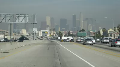
From the years roughly spanning the invention of the automobile to the invention of the smartphone, every driver in Los Angeles traveled with a Thomas Bros. map book. Those days are gone, but nostalgia for physical maps remains.
Bike + GPS = Digital Doodling Over the Streets of Baltimore
A Baltimore schoolteacher uses his phone and his bicycle to construct whimsical sketches on digital maps of the city, Nate Berg reports.

Interactive Map Reveals America's “Shade Deserts”
Launched by UCLA and American Forests to combat heat-related deaths, the tool maps the shade infrastructure for over 360 U.S. cities.

Planetizen Federal Action Tracker
A weekly monitor of how Trump’s orders and actions are impacting planners and planning in America.

Restaurant Patios Were a Pandemic Win — Why Were They so Hard to Keep?
Social distancing requirements and changes in travel patterns prompted cities to pilot new uses for street and sidewalk space. Then it got complicated.

Map: Where Senate Republicans Want to Sell Your Public Lands
For public land advocates, the Senate Republicans’ proposal to sell millions of acres of public land in the West is “the biggest fight of their careers.”

Maui's Vacation Rental Debate Turns Ugly
Verbal attacks, misinformation campaigns and fistfights plague a high-stakes debate to convert thousands of vacation rentals into long-term housing.

San Francisco Suspends Traffic Calming Amidst Record Deaths
Citing “a challenging fiscal landscape,” the city will cease the program on the heels of 42 traffic deaths, including 24 pedestrians.

California Homeless Arrests, Citations Spike After Ruling
An investigation reveals that anti-homeless actions increased up to 500% after Grants Pass v. Johnson — even in cities claiming no policy change.
Urban Design for Planners 1: Software Tools
This six-course series explores essential urban design concepts using open source software and equips planners with the tools they need to participate fully in the urban design process.
Planning for Universal Design
Learn the tools for implementing Universal Design in planning regulations.
Heyer Gruel & Associates PA
JM Goldson LLC
Custer County Colorado
City of Camden Redevelopment Agency
City of Astoria
Transportation Research & Education Center (TREC) at Portland State University
Camden Redevelopment Agency
City of Claremont
Municipality of Princeton (NJ)