


A "water atlas" compiled by UCLA's Luskin Center for Innovation reveals the patchwork that is Los Angeles' water supply system. Neighborhoods reliant on small providers and groundwater sources may be vulnerable.

Along with continuing drought, Los Angeles faces the challenges of decentralized water infrastructure. The city's "water grid" is a web of services ranging from local suppliers serving hundreds to the LADWP, with over 4 million customers.
Put together by the UCLA Luskin Center for Innovation, "the Los Angeles County Community Water System Atlas and Policy Guide uses maps and graphs to powerful effect to show the spectrum of these system types, and how they're equipped to handle severe water conditions."
CityLab's Laura Bliss writes, "Across the board, some 75 percent of these systems evidence some kind of supply vulnerability—whether due to their small size, dependence on a single water supply, contamination in local groundwater, or a projected increase in super hot days in the years to come."
While contaminated water isn't a problem for most residents, substandard water systems can have severe local impacts. "Individuals from disadvantaged communities—marked by linguistic isolation, poverty, and high unemployment—are more likely to suffer health impacts from drinking low-quality water than those from non-disadvantaged communities."
FULL STORY: Contaminated and Unregulated: A Worrying New 'Water Atlas' of L.A. County


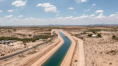
El Paso Wastewater Purification Facility Breaks Ground
As water supplies become strained and technology advances, cities look to wastewater as a viable source of drinking water.
Arizona Governor Takes Steps to Modernize Water Policy
A newly released report warns of rapidly dwindling groundwater resources as developers plan to build hundreds of thousands of new homes.

Utah Debates Solutions to Water Shortage
With a rapidly growing population and strained water supplies, Utah lawmakers and conservation groups debate how to best replenish the state's water sources.

Maui's Vacation Rental Debate Turns Ugly
Verbal attacks, misinformation campaigns and fistfights plague a high-stakes debate to convert thousands of vacation rentals into long-term housing.

Planetizen Federal Action Tracker
A weekly monitor of how Trump’s orders and actions are impacting planners and planning in America.

In Urban Planning, AI Prompting Could be the New Design Thinking
Creativity has long been key to great urban design. What if we see AI as our new creative partner?

Cal Fire Chatbot Fails to Answer Basic Questions
An AI chatbot designed to provide information about wildfires can’t answer questions about evacuation orders, among other problems.

What Happens if Trump Kills Section 8?
The Trump admin aims to slash federal rental aid by nearly half and shift distribution to states. Experts warn this could spike homelessness and destabilize communities nationwide.

Sean Duffy Targets Rainbow Crosswalks in Road Safety Efforts
Despite evidence that colorful crosswalks actually improve intersection safety — and the lack of almost any crosswalks at all on the nation’s most dangerous arterial roads — U.S. Transportation Secretary Duffy is calling on states to remove them.
Urban Design for Planners 1: Software Tools
This six-course series explores essential urban design concepts using open source software and equips planners with the tools they need to participate fully in the urban design process.
Planning for Universal Design
Learn the tools for implementing Universal Design in planning regulations.
Appalachian Highlands Housing Partners
Gallatin County Department of Planning & Community Development
Heyer Gruel & Associates PA
Mpact (founded as Rail~Volution)
City of Camden Redevelopment Agency
City of Astoria
City of Portland
City of Laramie