


Someone's done the hard work of finding, sorting, and stitching together millions of photos from the Internet to create animated portraits of the evolution of places.
James Vincent reports on a new project from researchers at Google and the University of Washington that animates places around the world by crowd sourcing publicly available images. Vincent explains:
"Researchers from Google and the University of Washington have found a way though, creating a powerful set of algorithms that automatically sorts millions of online photos into time-lapses of everything from skyscrapers to glaciers. The internet is plugged in at one end, and a record of our changing world comes out the other." They call it 'time-lapse mining.'"
The work allowed the team to create thousands of time-lapses of the most popular places on Earth—everything ranging from the Las Vegas Strip to the Briksdalsbreen Glacier in Norway, which you can see in the video below.
A paper documenting the work and more info is available at the project website.
FULL STORY: Public photos mined to create beautiful time-lapses

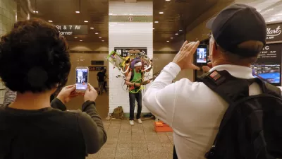
Friday Eye Candy: The Theatricality of the Subway
A new book of photography amplifies what was already there.
Friday Eye Candy: 195 Gigapixels of Urban Glory
An incredibly detailed bird's eye view of Shanghai.
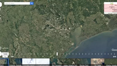
Friday Eye Candy: A 30-Year Timelapse Reveals Humanity's Expanding Footprint
The Google Timelapse feature has been updated. The only thing that stays the same is that everything changes.

Maui's Vacation Rental Debate Turns Ugly
Verbal attacks, misinformation campaigns and fistfights plague a high-stakes debate to convert thousands of vacation rentals into long-term housing.

Planetizen Federal Action Tracker
A weekly monitor of how Trump’s orders and actions are impacting planners and planning in America.

In Urban Planning, AI Prompting Could be the New Design Thinking
Creativity has long been key to great urban design. What if we see AI as our new creative partner?

Massachusetts Budget Helps Close MBTA Budget Gap
The budget signed by Gov. Maura Healey includes $470 million in MBTA funding for the next fiscal year.

Milwaukee Launches Vision Zero Plan
Seven years after the city signed its Complete Streets Policy, the city is doubling down on its efforts to eliminate traffic deaths.

Portland Raises Parking Fees to Pay for Street Maintenance
The city is struggling to bridge a massive budget gap at the Bureau of Transportation, which largely depleted its reserves during the Civd-19 pandemic.
Urban Design for Planners 1: Software Tools
This six-course series explores essential urban design concepts using open source software and equips planners with the tools they need to participate fully in the urban design process.
Planning for Universal Design
Learn the tools for implementing Universal Design in planning regulations.
Gallatin County Department of Planning & Community Development
Heyer Gruel & Associates PA
JM Goldson LLC
City of Camden Redevelopment Agency
City of Astoria
Transportation Research & Education Center (TREC) at Portland State University
Jefferson Parish Government
Camden Redevelopment Agency
City of Claremont