


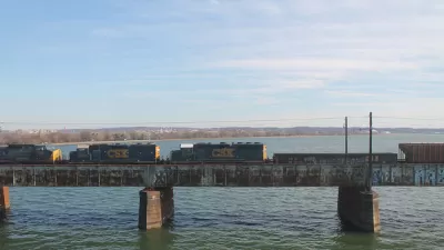
In anticipation of the expected opening of the H Street/Benning Road streetcar line in Washington, D.C., Peter Dovak examines the evolution of streetcar planning over the past 20 years.
According to Peter Dovak, "[y]ou can trace plans for modern streetcar service in the District back to the Transportation Vision, Strategy and Action Plan, which the District Department of Public Works completed in March of 1997. This plan identified a need for better inter-District transit to complement the Metro, and it proposed three possible streetcar lines to make that happen."
Since then the Washington Metropolitan Area Transit Authority has completed two studies, one in 1999 and another in 2002, recommending three and then four, respectively, possible streetcar lines "as part of a larger region-wide transit vision." The District Department of Transportation has also completed a number of studies under the DC's Transit Future program, including 2005's DC's Transit Future System Plan and Alternatives Analysis, which has subsequently been updated and expanded several times. The article includes links to all of the relevant studies, programs, and plans in the chronology.
Recent political winds and funding shortages have pared away the most robust proposals contained in these plans, and Dovak speculates that the success of the H Street/Benning Road streetcar line could determine the fate of gander visions for a streetcar network in and around the nation's capital. Dovak also promises a forthcoming series of articles examining the modern streetcar proposals in Northern Virginia and the two routes under construction in Washington, D.C.
FULL STORY: A history of streetcar planning in the District

Key Virginia Rail Bridge Project Completes Environmental Review
A $1.9 billion project to add a second set of rail tracks to the Long Bridge that connects Virginia to D.C. is ready to move forward with a recently completed Environmental Impact Statement.
Key Planning Details of the Proposed $1.9 Billion Rail Bridge Between D.C. and Virginia
Analysis of the Draft Environmental Impact Statement for a project that would add an additional bridge to supplement the rail capacity of the Long Bridge over the Potomac River.
D.C. Fare-Free Transit Program Could Come at the Expense of the K Street Transitway
When presented with a choice between investing in improved service or funding a fare-free program, the D.C. Council is choosing fare-free transit, and potentially overriding the wishes of the mayor.

Maui's Vacation Rental Debate Turns Ugly
Verbal attacks, misinformation campaigns and fistfights plague a high-stakes debate to convert thousands of vacation rentals into long-term housing.

Planetizen Federal Action Tracker
A weekly monitor of how Trump’s orders and actions are impacting planners and planning in America.

In Urban Planning, AI Prompting Could be the New Design Thinking
Creativity has long been key to great urban design. What if we see AI as our new creative partner?

King County Supportive Housing Program Offers Hope for Unhoused Residents
The county is taking a ‘Housing First’ approach that prioritizes getting people into housing, then offering wraparound supportive services.

Researchers Use AI to Get Clearer Picture of US Housing
Analysts are using artificial intelligence to supercharge their research by allowing them to comb through data faster. Though these AI tools can be error prone, they save time and housing researchers are optimistic about the future.

Making Shared Micromobility More Inclusive
Cities and shared mobility system operators can do more to include people with disabilities in planning and operations, per a new report.
Urban Design for Planners 1: Software Tools
This six-course series explores essential urban design concepts using open source software and equips planners with the tools they need to participate fully in the urban design process.
Planning for Universal Design
Learn the tools for implementing Universal Design in planning regulations.
planning NEXT
Appalachian Highlands Housing Partners
Mpact (founded as Rail~Volution)
City of Camden Redevelopment Agency
City of Astoria
City of Portland
City of Laramie