


"Depending on where you live in Melbourne, it could take longer to get into the city than it did in the 1920s," according to an article The Age. But really not much has changed.
Tom Cowie writes: We've come this beautiful 1925 colour-coded map from the Metropolitan Town Planning Commission. It shows the estimated time it took to journey into the city using public transport nearly 100 years ago."
"Public transport advocate Daniel Bowen says the map shows how little things have changed in Melbourne in the past century because there hasn't been a lot of new rail infrastructure."
The article provides a detailed analysis of the historic map and how it compares to current transit service. One note of hope: five times as many people live in Melbourne areas now as in 1925. That so many more people can reach the city in about the same amount of time should be seen as a significant benefit for transit over automobile commutes.
FULL STORY: Is your train commute quicker than 90 years ago? The answer might surprise you

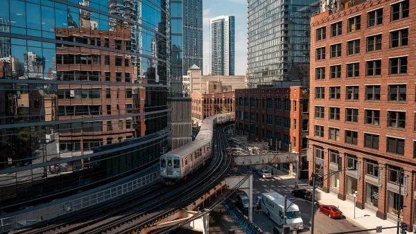
Chicago Transit: $770M Shortfall, 40% Service Cuts Loom
Despite dire warnings from transit officials, the Illinois General Assembly ended its legislative session without a solution.
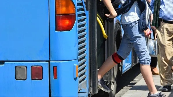
Opinion: Make Buses More Like Sidewalks
Sidewalks are an intuitive, low-cost, and easily accessible mobility tool. Can local buses function in the same way?
‘It’s Been 50 years’: Public Transit Law Passes in Montana
Legislation would fix transportation district issue, allow for greater reach on city bus routes.

Planetizen Federal Action Tracker
A weekly monitor of how Trump’s orders and actions are impacting planners and planning in America.

Maui's Vacation Rental Debate Turns Ugly
Verbal attacks, misinformation campaigns and fistfights plague a high-stakes debate to convert thousands of vacation rentals into long-term housing.

San Francisco Suspends Traffic Calming Amidst Record Deaths
Citing “a challenging fiscal landscape,” the city will cease the program on the heels of 42 traffic deaths, including 24 pedestrians.

Defunct Pittsburgh Power Plant to Become Residential Tower
A decommissioned steam heat plant will be redeveloped into almost 100 affordable housing units.

Trump Prompts Restructuring of Transportation Research Board in “Unprecedented Overreach”
The TRB has eliminated more than half of its committees including those focused on climate, equity, and cities.

Amtrak Rolls Out New Orleans to Alabama “Mardi Gras” Train
The new service will operate morning and evening departures between Mobile and New Orleans.
Urban Design for Planners 1: Software Tools
This six-course series explores essential urban design concepts using open source software and equips planners with the tools they need to participate fully in the urban design process.
Planning for Universal Design
Learn the tools for implementing Universal Design in planning regulations.
Heyer Gruel & Associates PA
JM Goldson LLC
Custer County Colorado
City of Camden Redevelopment Agency
City of Astoria
Transportation Research & Education Center (TREC) at Portland State University
Jefferson Parish Government
Camden Redevelopment Agency
City of Claremont