


If you're into place names and the history of presidential politics, we have just the map for you.
Using natural language processing algorithms followed by hand corrections, Mitch Fraas andf Benjamin Schmidt "have combed through these 224 State of the Union addresses and identified 16,408 mentions of 1,410 different places. Plotted on a map, the results reveal how American presidents have seen their nation and their world."
Proceeding through the map's chronologic cycle, the country's increasingly global purview manifests strikingly throughout the 1800s before subsiding in the 20th century.
The article also includes breakdowns by continent and global region by outside experts (like Dael Norwood, Dael an assistant professor of history at Binghamton University). A section focusing on the speeches of Franklin Delano Roosevelt is also included.
FULL STORY: Mapping the State of the Union

Mapped: Every Building in the United States
Using data from Microsoft, the New York Times has published an online map showing the placement of every building in the country, in a simple black and white format.
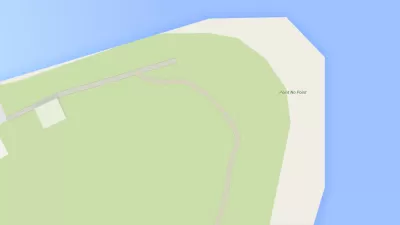
Friday Funny: The Instagram Account of Saddest Place Names Is Actually Kind of Sad
Did you know there's a place called Point No Point, in Hansville, Washington? It's quite pretty, actually, but is that reason enough to go there?

Interactive Map Reveals America's “Shade Deserts”
Launched by UCLA and American Forests to combat heat-related deaths, the tool maps the shade infrastructure for over 360 U.S. cities.

Planetizen Federal Action Tracker
A weekly monitor of how Trump’s orders and actions are impacting planners and planning in America.

Chicago’s Ghost Rails
Just beneath the surface of the modern city lie the remnants of its expansive early 20th-century streetcar system.

San Antonio and Austin are Fusing Into one Massive Megaregion
The region spanning the two central Texas cities is growing fast, posing challenges for local infrastructure and water supplies.

Since Zion's Shuttles Went Electric “The Smog is Gone”
Visitors to Zion National Park can enjoy the canyon via the nation’s first fully electric park shuttle system.

Trump Distributing DOT Safety Funds at 1/10 Rate of Biden
Funds for Safe Streets and other transportation safety and equity programs are being held up by administrative reviews and conflicts with the Trump administration’s priorities.

German Cities Subsidize Taxis for Women Amid Wave of Violence
Free or low-cost taxi rides can help women navigate cities more safely, but critics say the programs don't address the root causes of violence against women.
Urban Design for Planners 1: Software Tools
This six-course series explores essential urban design concepts using open source software and equips planners with the tools they need to participate fully in the urban design process.
Planning for Universal Design
Learn the tools for implementing Universal Design in planning regulations.
planning NEXT
Appalachian Highlands Housing Partners
Mpact (founded as Rail~Volution)
City of Camden Redevelopment Agency
City of Astoria
City of Portland
City of Laramie