


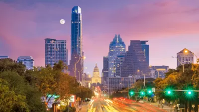
A Dallas Morning News column illustrates the evolution of Austin by exploring the changes in the neighborhoods along the city's famous Sixth Street corridor.
Marissa Barnett traces the evolution of Austin along the length of Sixth Street, "from the eastern edge of Sixth Street — where old neglect is being painted and polished into slick restaurants and coffeehouses — through downtown and onto the glass high-rise and corporate domain of its western edge."
Barnett notices the kinds of changes visible in the different neighborhoods found along the street: First, "to the east, past I-35, Mexican restaurants and auto repair shops are mixing with highbrow restaurants, art galleries and hipster bars. Ramshackle cottages are disappearing, and the displacement of working-class families is causing tension in a city that had always prided itself on inclusion."
And "to the west is where the city has grown up. It’s where the corporate headquarters of Whole Foods shares the stretch with upscale eateries, such as actress Sandra Bullock’s Bess Bistro and Cafe Josie, and high-end retail stores including Lululemon and Anthropologie. The sidewalks are dwarfed by a surge of new high-rise condos."
The article goes on to detail what are described as three distinct neighborhoods along Sixth Street: the aforementioned eastern and western neighborhoods in addition to the "Dirty Sixth" party neighborhood.
FULL STORY: Austin’s Sixth Street shows the city’s evolution

Austin Employs Team to Help Residents Avoid Displacement
The city’s new Displacement Prevention Navigators will conduct outreach and assist with finding resources to help cost-burdened residents at risk of losing their housing stay in their homes.

Austin Now Taking Applications for its ‘Right to Return’ to Gentrifying Neighborhoods
The Texas state capital’s “right to return” law was delayed by the pandemic, but Austin is now taking applications for longtime low-income residents to find housing in gentrifying neighborhoods.
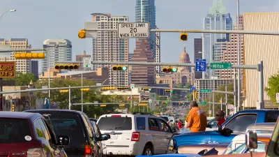
Austin Becoming Least Affordable City Outside California
The Texas capital, once one of the most affordable metro areas, is experiencing a housing affordability crisis as median prices soar and longtime residents face displacement.

Maui's Vacation Rental Debate Turns Ugly
Verbal attacks, misinformation campaigns and fistfights plague a high-stakes debate to convert thousands of vacation rentals into long-term housing.

Planetizen Federal Action Tracker
A weekly monitor of how Trump’s orders and actions are impacting planners and planning in America.

In Urban Planning, AI Prompting Could be the New Design Thinking
Creativity has long been key to great urban design. What if we see AI as our new creative partner?

King County Supportive Housing Program Offers Hope for Unhoused Residents
The county is taking a ‘Housing First’ approach that prioritizes getting people into housing, then offering wraparound supportive services.

Researchers Use AI to Get Clearer Picture of US Housing
Analysts are using artificial intelligence to supercharge their research by allowing them to comb through data faster. Though these AI tools can be error prone, they save time and housing researchers are optimistic about the future.

Making Shared Micromobility More Inclusive
Cities and shared mobility system operators can do more to include people with disabilities in planning and operations, per a new report.
Urban Design for Planners 1: Software Tools
This six-course series explores essential urban design concepts using open source software and equips planners with the tools they need to participate fully in the urban design process.
Planning for Universal Design
Learn the tools for implementing Universal Design in planning regulations.
planning NEXT
Appalachian Highlands Housing Partners
Mpact (founded as Rail~Volution)
City of Camden Redevelopment Agency
City of Astoria
City of Portland
City of Laramie