


Southern California is in the process of undoing the decades of planning that has left LAX isolated and inaccessible except through an ocean of congestion and frustration. Plans to connect the airport to the region recently gained critical approval.
Adrian Glick Kudler reports that "the [Los Angeles World Airports] Board of Airport Commissioners voted to move ahead on the $4-billion Landside Access Modernization Program, which includes a new consolidated rental car center, new pick-off/drop-off/parking areas, and—most gamechangingly of all—an automated people mover to connect those spots with a stop on the forthcoming Crenshaw Line light rail and, of course, with LAX's central terminal area."
Glick Kudler details the Landside Access Modernization Program on several critical points, including the Consolidated Rent-A-Car Center, two intermodal transportation facilities, an adjacent light rail station, and the automated people mover that will connect all of the facilities in LAX's orbit.
Glick Kudler's reporting follows an announcement from the office of Mayor Eric Garcetti announcing the discussion. In typical Curbed style, the article is replete with links to access the backstory on Los Angeles' ongoing project to connect the airport with the rest of the region by modes other than the automobile.
FULL STORY: Here's the Mindblowing Plan to Un-Fuck LAX Transportation

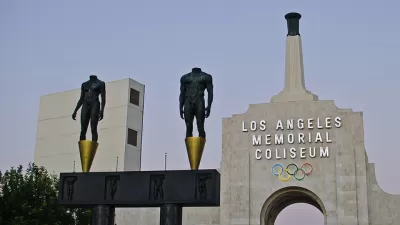
Los Angeles Investing in a Transit-Oriented Olympics
Ahead of the 2028 Olympic Games, Los Angeles is rallying around infrastructure buildout and technological advancement.
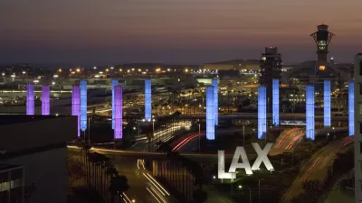
Multimodal Transit Hub Planned for LAX
A light-rail link to the Los Angeles International Airport would accommodate bikes and buses, and could be here by 2021.
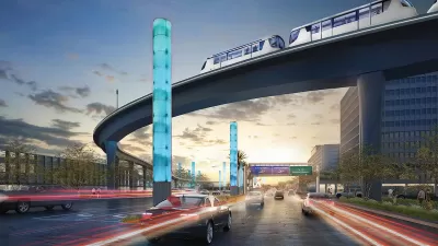
LA City Council Approves Extra Funding for LAX People Mover
The automated electric rail system is expected to carry up to 30 million passengers per year to points in and around the Los Angeles International Airport.

Maui's Vacation Rental Debate Turns Ugly
Verbal attacks, misinformation campaigns and fistfights plague a high-stakes debate to convert thousands of vacation rentals into long-term housing.

Planetizen Federal Action Tracker
A weekly monitor of how Trump’s orders and actions are impacting planners and planning in America.

San Francisco Suspends Traffic Calming Amidst Record Deaths
Citing “a challenging fiscal landscape,” the city will cease the program on the heels of 42 traffic deaths, including 24 pedestrians.

Defunct Pittsburgh Power Plant to Become Residential Tower
A decommissioned steam heat plant will be redeveloped into almost 100 affordable housing units.

Trump Prompts Restructuring of Transportation Research Board in “Unprecedented Overreach”
The TRB has eliminated more than half of its committees including those focused on climate, equity, and cities.

Amtrak Rolls Out New Orleans to Alabama “Mardi Gras” Train
The new service will operate morning and evening departures between Mobile and New Orleans.
Urban Design for Planners 1: Software Tools
This six-course series explores essential urban design concepts using open source software and equips planners with the tools they need to participate fully in the urban design process.
Planning for Universal Design
Learn the tools for implementing Universal Design in planning regulations.
Heyer Gruel & Associates PA
JM Goldson LLC
Custer County Colorado
City of Camden Redevelopment Agency
City of Astoria
Transportation Research & Education Center (TREC) at Portland State University
Jefferson Parish Government
Camden Redevelopment Agency
City of Claremont