


Yonah Freemark writes about the remarkable success of the boomtown of Calgary, Alberta—a city described as "a lot more like Dallas or Phoenix than Copenhagen."

Yonah Freemark explains that Calgary, where 87 percent of locals live in suburban environments, "is attracting big crowds to its transit system, and those crowds continue to increase in size…. demonstrating that even when residential land use is oriented strongly towards auto dependency, it is possible to encourage massive use of the transit system."
Freemark credits the expansion of the C-Train (the second-most-heavily used light rail system in North America) along with heavy, and growing, use of the bus network for some of that success. "Indeed, Calgary buses now are providing about 20 million more annual rides than they were in 1996. Overall, the transit system is carrying about 80 million more riders annually than it was 17 years ago." Freemark notes that that growth has outpaced population growth in the city over that period.
But comparing Calgary's investments with the transit investments of a city like Dallas, according to Freemark's analysis, requires another explanation for the success of the Canadian city. Freemark goes on to detail the key to Calgary's success: strategies in downtown that minimize the use of automobiles.
FULL STORY: Calgary’s soaring transit use suggests high ridership is possible even in sprawling cities

APTA Requests CDL Testing Change to Address Bus Operator Shortage
Eighty-four percent of U.S. transit agencies surveyed said CDL complexity was a hiring obstacle, with the “under-the-hood” requirement being the most challenging.
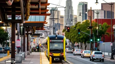
L.A. Transit Surpasses 1M Weekday Riders for First Time Since Pandemic
Rail and bus ridership in the Los Angeles metropolitan area is recovering at a faster rate than the national average.

Flixbus Nearing Deal With Chicago Bus Terminal
Greyhound is shedding stations around the country, but Chicago intercity bus passengers will still be able to use the city’s main bus terminal — for now.

Planetizen Federal Action Tracker
A weekly monitor of how Trump’s orders and actions are impacting planners and planning in America.

Chicago’s Ghost Rails
Just beneath the surface of the modern city lie the remnants of its expansive early 20th-century streetcar system.

San Antonio and Austin are Fusing Into one Massive Megaregion
The region spanning the two central Texas cities is growing fast, posing challenges for local infrastructure and water supplies.

Since Zion's Shuttles Went Electric “The Smog is Gone”
Visitors to Zion National Park can enjoy the canyon via the nation’s first fully electric park shuttle system.

Trump Distributing DOT Safety Funds at 1/10 Rate of Biden
Funds for Safe Streets and other transportation safety and equity programs are being held up by administrative reviews and conflicts with the Trump administration’s priorities.

German Cities Subsidize Taxis for Women Amid Wave of Violence
Free or low-cost taxi rides can help women navigate cities more safely, but critics say the programs don't address the root causes of violence against women.
Urban Design for Planners 1: Software Tools
This six-course series explores essential urban design concepts using open source software and equips planners with the tools they need to participate fully in the urban design process.
Planning for Universal Design
Learn the tools for implementing Universal Design in planning regulations.
planning NEXT
Appalachian Highlands Housing Partners
Mpact (founded as Rail~Volution)
City of Camden Redevelopment Agency
City of Astoria
City of Portland
City of Laramie