


Jordan Fraade writes of the embarrassing mishap of the New York City department that misread its own zoning maps. What else are we missing, and at what cost, because of byzantine land use regulations?
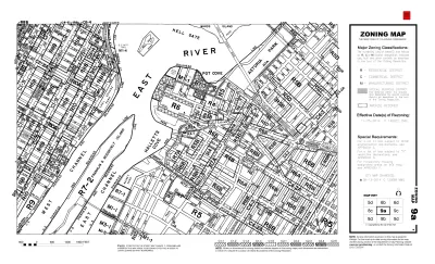
Fraade begins this tale of the high costs of broken zoning codes by citing the example of the New York City Department of Housing Preservation and Development, which realized in October that they had misread their own map.
"Late in October, planners took another look at the city’s zoning map and realized they made an error. Astoria Cove’s affordable apartments will actually have to target families making a maximum of 60 percent of AMI [rather than the 80 percent originally thought]."
Fraade notes the emotional and economic consequences of the reality of zoning in cities like New York City: "For New Yorkers who have spent decades trying to navigate the city’s housing market, it’s a small comfort to know that not even city planners can make sense of the city’s web of zoning policies. But this is nothing compared to the comfort that landlords feel, safe in the knowledge that they’ve used zoning to game the system."
Fraade goes on to draw some comparisons between the New York experience with examples from Los Angeles, Toronto, and Montreal, especially in light of the ongoing housing crisis in many cities around the world.
FULL STORY: Blame America’s housing woes on zoning laws


NYC: What Mamdani’s Rivals Can Teach Him About Transportation
The mayoral candidate won on a bold, progressive platform. Some of his opponents had even bolder ideas.

NYC Council Approves Brooklyn Rezoning Plan
The Atlantic Avenue Mixed Use Plan includes infrastructure investments and could bring 4,600 new housing units to parts of Brooklyn.

Lawsuit Aims to Stop NYC’s ‘City of Yes’ Zoning Reforms
A lawsuit brought by local lawmakers and community groups claims the plan failed to conduct a comprehensive environmental review.

Maui's Vacation Rental Debate Turns Ugly
Verbal attacks, misinformation campaigns and fistfights plague a high-stakes debate to convert thousands of vacation rentals into long-term housing.

Planetizen Federal Action Tracker
A weekly monitor of how Trump’s orders and actions are impacting planners and planning in America.

San Francisco Suspends Traffic Calming Amidst Record Deaths
Citing “a challenging fiscal landscape,” the city will cease the program on the heels of 42 traffic deaths, including 24 pedestrians.

Defunct Pittsburgh Power Plant to Become Residential Tower
A decommissioned steam heat plant will be redeveloped into almost 100 affordable housing units.

Trump Prompts Restructuring of Transportation Research Board in “Unprecedented Overreach”
The TRB has eliminated more than half of its committees including those focused on climate, equity, and cities.

Amtrak Rolls Out New Orleans to Alabama “Mardi Gras” Train
The new service will operate morning and evening departures between Mobile and New Orleans.
Urban Design for Planners 1: Software Tools
This six-course series explores essential urban design concepts using open source software and equips planners with the tools they need to participate fully in the urban design process.
Planning for Universal Design
Learn the tools for implementing Universal Design in planning regulations.
Heyer Gruel & Associates PA
JM Goldson LLC
Custer County Colorado
City of Camden Redevelopment Agency
City of Astoria
Transportation Research & Education Center (TREC) at Portland State University
Jefferson Parish Government
Camden Redevelopment Agency
City of Claremont