


A blighted abandoned rail corridor through South Los Angeles received funding to plan a rail to trail conversion. Can residents compel officials to complete the sorely needed open space facility?
The Los Angeles County Metropolitan Transportation Authority recently "approved $2.8 million to plan a 'rail-to-river' path along Slauson Avenue from the Los Angeles River to the Crenshaw Metro line — one of the most blighted parts of the city." The project, reports Andrea Gardner, would "transform eight miles of abandoned roadway into a bike and pedestrian path" at an estimated cost of $35 million.
The article (which also includes an audio version from its radio broadcast) also focuses on the neighborhood and residents who would benefit by the conversion. "Residents told the board the project was needed in a community known for high obesity and a low rate of car ownership. Many noted that South Los Angeles is also 'park poor,' with less than 2 acres of park space for every 1,000 residents. By comparion [sic], West Los Angeles has more than 50 acres of park space for every 1,000 residents."
FULL STORY: South Los Angeles residents push to transform railway to 8-mile greenbelt


L.A. Metro Will Spend $81.5 Million to Improve Blue Line to Long Beach
The Los Angeles County Metropolitan Transportation Authority (Metro) appears to be taking a break from its perpetual expansion projects to make some improvements to the heavily used but aging Blue Line.
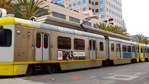
The World’s Longest Light Rail Line is in… Los Angeles?
In a city not known for its public transit, the 48.5-mile A Line is the longest of its kind on the planet.

Improving South Los Angeles Through Strategic Tree Planting
The University of Southern California Urban Trees Initiative is planting 250 trees in South L.A. neighborhoods to improve shade, combat climate change, and enhance community well-being through collaboration and data-driven approaches.

Maui's Vacation Rental Debate Turns Ugly
Verbal attacks, misinformation campaigns and fistfights plague a high-stakes debate to convert thousands of vacation rentals into long-term housing.

Planetizen Federal Action Tracker
A weekly monitor of how Trump’s orders and actions are impacting planners and planning in America.

In Urban Planning, AI Prompting Could be the New Design Thinking
Creativity has long been key to great urban design. What if we see AI as our new creative partner?

King County Supportive Housing Program Offers Hope for Unhoused Residents
The county is taking a ‘Housing First’ approach that prioritizes getting people into housing, then offering wraparound supportive services.

Researchers Use AI to Get Clearer Picture of US Housing
Analysts are using artificial intelligence to supercharge their research by allowing them to comb through data faster. Though these AI tools can be error prone, they save time and housing researchers are optimistic about the future.

Making Shared Micromobility More Inclusive
Cities and shared mobility system operators can do more to include people with disabilities in planning and operations, per a new report.
Urban Design for Planners 1: Software Tools
This six-course series explores essential urban design concepts using open source software and equips planners with the tools they need to participate fully in the urban design process.
Planning for Universal Design
Learn the tools for implementing Universal Design in planning regulations.
planning NEXT
Appalachian Highlands Housing Partners
Mpact (founded as Rail~Volution)
City of Camden Redevelopment Agency
City of Astoria
City of Portland
City of Laramie