


Faced with the prospect of states seizing control of federal lands to potentially sell to private owners, a resident of New Mexico argues against "the land grab out west."
"With a script similar to one used last spring by the Nevada rancher Cliven Bundy, a small contingent of opportunistic politicians is vowing to dispose of America’s national forests, conservation lands and open space," writes Martin Heinrich.
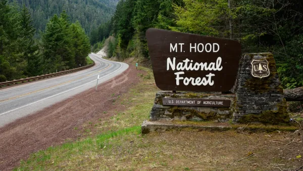
Utah was the first state to embark on this course. In 2012, the state’s Republican governor, Gary Herbert, signed a law demanding (though unsuccessfully so far) that the federal government transfer to the state more than 20 million acres owned by United States taxpayers. This included national forests and grasslands and such jewels as Lake Powell and the Flaming Gorge National Recreation Area.
In turn, the legislatures in Idaho, Montana, Nevada and Wyoming have created task forces to study the idea, though similar efforts in Colorado and my home state of New Mexico have thus far failed.
According to Heinrich, the states argue that they are better fit to manage the lands than federal agencies like the United States Forest Service of the Bureau of Land Management. Heinrich identifies the American Lands Council as a key lobbyists behind the recent legislative efforts, noting that "the Republican National Committee has bought the snake oil the American Lands Council is selling. Last January, the committee endorsed [pdf] the transfer of public lands to the states. In addition, the United States House of Representatives, controlled by Republicans, endorsed the outright sale of our public lands."
FULL STORY: The Land Grab Out West

US Forest Service Could Open Millions of Roadless Acres to Logging
The USDA indicated it plans to repeal the ‘Roadless Rule,’ a Clinton-era regulation that prevents new road-building in undeveloped federal forest areas.
New Executive Order Renews Attack on Public Lands
An order issued late last week pushes for increased mineral extraction on federally owned public lands.

US Forest Service Announces Hiring Freeze for 2025 Fiscal Year
A looming budget cut has led the Forest service to hit pause on seasonal staff hires and hiring external candidates for permanent agency positions, prompting concerns about the agency’s ability to achieve its mission.

Planetizen Federal Action Tracker
A weekly monitor of how Trump’s orders and actions are impacting planners and planning in America.

Maui's Vacation Rental Debate Turns Ugly
Verbal attacks, misinformation campaigns and fistfights plague a high-stakes debate to convert thousands of vacation rentals into long-term housing.

San Francisco Suspends Traffic Calming Amidst Record Deaths
Citing “a challenging fiscal landscape,” the city will cease the program on the heels of 42 traffic deaths, including 24 pedestrians.

Defunct Pittsburgh Power Plant to Become Residential Tower
A decommissioned steam heat plant will be redeveloped into almost 100 affordable housing units.

Trump Prompts Restructuring of Transportation Research Board in “Unprecedented Overreach”
The TRB has eliminated more than half of its committees including those focused on climate, equity, and cities.

Amtrak Rolls Out New Orleans to Alabama “Mardi Gras” Train
The new service will operate morning and evening departures between Mobile and New Orleans.
Urban Design for Planners 1: Software Tools
This six-course series explores essential urban design concepts using open source software and equips planners with the tools they need to participate fully in the urban design process.
Planning for Universal Design
Learn the tools for implementing Universal Design in planning regulations.
Heyer Gruel & Associates PA
JM Goldson LLC
Custer County Colorado
City of Camden Redevelopment Agency
City of Astoria
Transportation Research & Education Center (TREC) at Portland State University
Jefferson Parish Government
Camden Redevelopment Agency
City of Claremont