


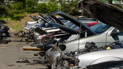
There isn't one way to measure how badly groups of people (like, say, residents of New Jersey) drive, but there is plenty of data available about how driving often goes terribly wrong.
Mona Chalabi crunches the numbers on the age-old question of which states have the worst drivers by citing three types of historic data: "The number of car crashes in each state (especially those where the driver was negligent in some way), how much insurance companies pay out, and how much insurance companies charge drivers."
Chalabi breaks down those categories even further with statistics like "Drivers involved in fatal collisions while speeding" and many others. Her answer to the question of which state has the worst drivers: "there's no easy answer..."
FULL STORY: Dear Mona, Which State Has The Worst Drivers?


Let’s End Traffic Stops
The technology to make traffic enforcement obsolete is becoming available. But in the U.S. willing to use it?

Dangerous, Distracted Drivers Take More Joyrides During Lockdown
Some motorists see open roads as an opportunity for stress relief. Transportation officials urge motorists to slow down, citing dramatically increased rates of speeding since the onset of the pandemic.
California Car Collision Rates Decline After Shelter-in-Place Mandates
A hopeful forecast predicts that thousands of monthly traffic collisions will be avoided due to reduced vehicular travel during California’s shelter-in-place period.

Maui's Vacation Rental Debate Turns Ugly
Verbal attacks, misinformation campaigns and fistfights plague a high-stakes debate to convert thousands of vacation rentals into long-term housing.

Planetizen Federal Action Tracker
A weekly monitor of how Trump’s orders and actions are impacting planners and planning in America.

San Francisco Suspends Traffic Calming Amidst Record Deaths
Citing “a challenging fiscal landscape,” the city will cease the program on the heels of 42 traffic deaths, including 24 pedestrians.

Defunct Pittsburgh Power Plant to Become Residential Tower
A decommissioned steam heat plant will be redeveloped into almost 100 affordable housing units.

Trump Prompts Restructuring of Transportation Research Board in “Unprecedented Overreach”
The TRB has eliminated more than half of its committees including those focused on climate, equity, and cities.

Amtrak Rolls Out New Orleans to Alabama “Mardi Gras” Train
The new service will operate morning and evening departures between Mobile and New Orleans.
Urban Design for Planners 1: Software Tools
This six-course series explores essential urban design concepts using open source software and equips planners with the tools they need to participate fully in the urban design process.
Planning for Universal Design
Learn the tools for implementing Universal Design in planning regulations.
Heyer Gruel & Associates PA
JM Goldson LLC
Custer County Colorado
City of Camden Redevelopment Agency
City of Astoria
Transportation Research & Education Center (TREC) at Portland State University
Jefferson Parish Government
Camden Redevelopment Agency
City of Claremont