


Officials planning the divisive Opportunity Corridor in Cleveland are working to catch land use considerations up with transportation considerations for a proposed road connection to cut through the city's East Side.
Steven Litt provides the latest details of the conversation regarding Cleveland's planned Opportunity Corridor, a five-lane, 3.5-mile boulevard between University Circle and I-490 on the city's East Side. Specifically, Litt's coverage addresses the need for good planning to make the most of the new route.
"Without excellent new planning, zoning and urban design guidelines and special design review procedures for the hundreds of acres of land on either side of the new road, Cleveland could be in danger of getting lowest common denominator development."
Namely: "If the worst comes to pass, the new boulevard – literally a $100 million-a-mile infrastructure investment - could be lined with gas stations, and lube joints, sprinkled among used car lots and payday loan stores. In other words, it could become another Carnegie Avenue."
Litt notes that the land use planning for the area along the corridor has lagged behind the roadway planning for the Opportunity Corridor. He also notes that Angie Schmitt from Streetsblog USA, among others, has "excoriated Opportunity Corridor as a foolish exercise in 1950s-style highway planning."

Study: Affordable Housing Development Raises Nearby Property Values
More evidence that a common talking point of affordable housing opposition is more fear than fact.
Equitable Transportation Planning Initiative Advances in Northeast Ohio
The Northeast Ohio Areawide Coordinating Agency (NOACA) is moving forward with a groundbreaking policy to consider regional economic inequities when evaluating potential highway projects.
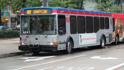
Bus System Redesign Coming to the Cleveland Region
The Greater Cleveland Regional Transit Authority (RTA) revealed a draft system redesign this week.

Planetizen Federal Action Tracker
A weekly monitor of how Trump’s orders and actions are impacting planners and planning in America.

Restaurant Patios Were a Pandemic Win — Why Were They so Hard to Keep?
Social distancing requirements and changes in travel patterns prompted cities to pilot new uses for street and sidewalk space. Then it got complicated.

Map: Where Senate Republicans Want to Sell Your Public Lands
For public land advocates, the Senate Republicans’ proposal to sell millions of acres of public land in the West is “the biggest fight of their careers.”

Maui's Vacation Rental Debate Turns Ugly
Verbal attacks, misinformation campaigns and fistfights plague a high-stakes debate to convert thousands of vacation rentals into long-term housing.

San Francisco Suspends Traffic Calming Amidst Record Deaths
Citing “a challenging fiscal landscape,” the city will cease the program on the heels of 42 traffic deaths, including 24 pedestrians.

California Homeless Arrests, Citations Spike After Ruling
An investigation reveals that anti-homeless actions increased up to 500% after Grants Pass v. Johnson — even in cities claiming no policy change.
Urban Design for Planners 1: Software Tools
This six-course series explores essential urban design concepts using open source software and equips planners with the tools they need to participate fully in the urban design process.
Planning for Universal Design
Learn the tools for implementing Universal Design in planning regulations.
Heyer Gruel & Associates PA
JM Goldson LLC
Custer County Colorado
City of Camden Redevelopment Agency
City of Astoria
Transportation Research & Education Center (TREC) at Portland State University
Camden Redevelopment Agency
City of Claremont
Municipality of Princeton (NJ)