


Grosse Point Park, which borders Detroit, has blocked streets that connect its commercial district from the east side of Detroit. An editorial from the Detroit News says that the focus should be on making Detroit a better neighbor.
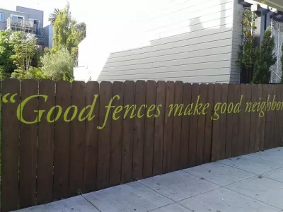
The editorial begins by admitting that if it looks like a duck, and walks like a duck: "Grosse Pointe Park is being accused of trying to wall itself off from Detroit by erecting farmer sheds across Kercheval Avenue at its border with the city. And that’s a hard assertion to deny."
Then this: "But consider what the suburban community is walling itself off from. The area of Detroit’s east side that borders Grosse Pointe Park is among the most blighted in the city, perhaps in the country."
The sheds, according to the editorial, are part of an effort to transform Grosse Pointe Park's "business district on Kercheval into one of the coolest outside of downtown Detroit. New restaurants and retail shops have opened, and the city is trying to create a pedestrian-friendly entertainment district." According to the editorial, "[the] temporary structures across Kercheval force traffic to go around the central business district, instead of straight through it. That cuts down on traffic."
There's more equivocation from the Detroit News editorial staff at the link below.
FULL STORY: Grosse Pointe Park stands up to blight

Comparing the Racial Segregation of U.S. Cities
The City Observatory used American Community Survey from the U.S. Census to compare the segregation of the largest U.S. cities. Portland is the most integrated American city; Detroit is the most segregated U.S. city.

Black-White Segregation Decreasing, Slowly
Segregation is decreasing, even in America’s most segregated big cities.

Report Details Racial Inequality in Four Cities
Five decades after the Fair Housing Act, racial inequality is still rampant in American cities. Trulia and the National Fair Housing Alliance collaborated on this report on four of them.

Maui's Vacation Rental Debate Turns Ugly
Verbal attacks, misinformation campaigns and fistfights plague a high-stakes debate to convert thousands of vacation rentals into long-term housing.

Planetizen Federal Action Tracker
A weekly monitor of how Trump’s orders and actions are impacting planners and planning in America.

In Urban Planning, AI Prompting Could be the New Design Thinking
Creativity has long been key to great urban design. What if we see AI as our new creative partner?

Portland Raises Parking Fees to Pay for Street Maintenance
The city is struggling to bridge a massive budget gap at the Bureau of Transportation, which largely depleted its reserves during the Civd-19 pandemic.

Spokane Mayor Introduces Housing Reforms Package
Mayor Lisa Brown’s proposals include deferring or waiving some development fees to encourage more affordable housing development.

Houston Mayor Kills Another Bike Lane
The mayor rejected a proposed bike lane in the Montrose district in keeping with his pledge to maintain car lanes.
Urban Design for Planners 1: Software Tools
This six-course series explores essential urban design concepts using open source software and equips planners with the tools they need to participate fully in the urban design process.
Planning for Universal Design
Learn the tools for implementing Universal Design in planning regulations.
Gallatin County Department of Planning & Community Development
Heyer Gruel & Associates PA
JM Goldson LLC
City of Camden Redevelopment Agency
City of Astoria
Transportation Research & Education Center (TREC) at Portland State University
Jefferson Parish Government
Camden Redevelopment Agency
City of Claremont