


Knowledge is power when it comes to environmental justice, and a group of students from UCLA has recently armed residents of Los Angeles with a mapping tool that tracks the amount of toxins emitted by local factories.
"UCLA has launched a new interactive map tracking the impact of toxins from local factories on the environment in Los Angeles County. Developed by seven students, it details more than eight million pounds of toxic chemicals released into the environment during 2012," according to Lata Pandya.
"The group looked at the petroleum, chemicals, primary metals, and fabricated metals industries, which make up 89 percent of toxins in the county. With data from 172 facilities that are required to report toxin releases to the government, students developed an environmental impact rating system."
Included on the list is Exide Technologies, a battery recycler located in the city of Vernon just outside of Los Angeles. Exide had one of the highest scores on the rating, a 78. Last fall, the Los Angeles Times reported that Exide had poisoned potentially hundreds of thousands of residents with lead and arsenic (the Times now cites a 100,000 number). Exide and the Environmental Protection agency are continuing to wrangle over its hazardous waste permit, although the plant has been idle since March.
FULL STORY: New Map by UCLA Shows Factory Toxins in L.A. County

Los Angeles Breathing Easier Due to Reductions in Airborne Toxins
The improvement in air quality comes from reductions in toxic emissions from autos, trucks, and ships. Enjoying the cleaner air were tens of thousands of Angelenos riding on miles of streets closed to auto traffic for the 10th CicLAvia event.
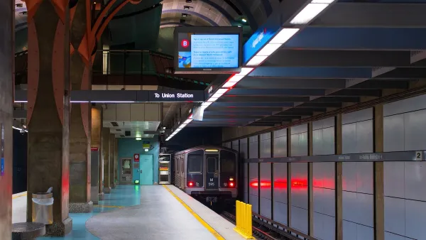
LA Transit Ridership Plummets Amidst ICE Raids
LA Metro’s bus and rail lines are seeing up to 15 percent lower ridership in the wake of violent immigration arrests.

Southern Californians Survey Trees for Destructive Oak Pest
Hundreds of volunteers across five counties participated in the first Goldspotted Oak Borer Blitz, surveying oak trees for signs of the invasive beetle and contributing valuable data to help protect Southern California’s native woodlands.

Maui's Vacation Rental Debate Turns Ugly
Verbal attacks, misinformation campaigns and fistfights plague a high-stakes debate to convert thousands of vacation rentals into long-term housing.

Planetizen Federal Action Tracker
A weekly monitor of how Trump’s orders and actions are impacting planners and planning in America.

San Francisco Suspends Traffic Calming Amidst Record Deaths
Citing “a challenging fiscal landscape,” the city will cease the program on the heels of 42 traffic deaths, including 24 pedestrians.

Defunct Pittsburgh Power Plant to Become Residential Tower
A decommissioned steam heat plant will be redeveloped into almost 100 affordable housing units.

Trump Prompts Restructuring of Transportation Research Board in “Unprecedented Overreach”
The TRB has eliminated more than half of its committees including those focused on climate, equity, and cities.

Amtrak Rolls Out New Orleans to Alabama “Mardi Gras” Train
The new service will operate morning and evening departures between Mobile and New Orleans.
Urban Design for Planners 1: Software Tools
This six-course series explores essential urban design concepts using open source software and equips planners with the tools they need to participate fully in the urban design process.
Planning for Universal Design
Learn the tools for implementing Universal Design in planning regulations.
Heyer Gruel & Associates PA
JM Goldson LLC
Custer County Colorado
City of Camden Redevelopment Agency
City of Astoria
Transportation Research & Education Center (TREC) at Portland State University
Jefferson Parish Government
Camden Redevelopment Agency
City of Claremont