


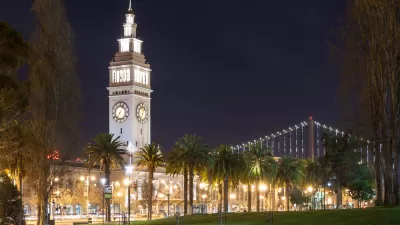
The eventuality predicted since San Francisco's Prop. B qualified for the ballot has come to pass, with more than 59 percent of San Francisco voters approving the ordinance that will require votes on developments exceeding existing height limits.
"Residents overwhelmingly approved a ballot measure Tuesday to give voters a say in development along a 7 1/2-mile stretch of San Francisco's waterfront," according to a report by John Wildermuth and John Coté.
"The measure will require voter approval for any new building on Port of San Francisco property to exceed existing height limits, which typically range from 40 to 80 feet but can be as low as zero and as high as 105 feet."
In the article, Wildermuth and Coté quote a "disappointed" Gabriel Metcalf, executive director of the urban think tank SPUR: "Today, San Francisco took another step toward becoming the most expensive city in the country. ... We fell for a simplistic slogan and effectively shut off thousands of future housing units."
Matthew Yglesias agrees with Metcalf in a post for Vox, citing a tweet by Mother Jones Editor Clara Jeffrey as the voice of "discerning Bay Area progressives." Writes Yglesias: "But in San Francisco there is a basic underlying reality. The city's physical dimensions are constrained, and a lot of people would like to live and work there. Thanks to the miraculous technology of the elevator, it is perfectly possible for lots of people to live and work in a small geographical area via the mechanism of tall buildings."
FULL STORY: S.F. voters OK Prop. B on waterfront development


Trial Over San Francisco Waterfront Development Height Limits Begins
The State Lands Commission filed suit shortly after San Francisco voters approved Prop. B in June 2014, requiring waterfront developments exceeding height limits to obtain voter approval rather than go through the Planning Commission process.
With Ballot Box Zoning Likely to Pass—What Next for San Francisco?
C.W. Nevius examines the consequences of Proposition B—on the ballot in San Francisco in June.
San Francisco Voters Increase Height Limits for Waterfront Development
Voters gave Forest City Enterprises' Pier 70 development the go-ahead on Tuesday by increasing height limits from 40 to 90 feet. The 65-acre property will be developed into mixed use, with 2,000 housing units, 30 percent affordable, and open space.

Maui's Vacation Rental Debate Turns Ugly
Verbal attacks, misinformation campaigns and fistfights plague a high-stakes debate to convert thousands of vacation rentals into long-term housing.

Planetizen Federal Action Tracker
A weekly monitor of how Trump’s orders and actions are impacting planners and planning in America.

San Francisco Suspends Traffic Calming Amidst Record Deaths
Citing “a challenging fiscal landscape,” the city will cease the program on the heels of 42 traffic deaths, including 24 pedestrians.

Defunct Pittsburgh Power Plant to Become Residential Tower
A decommissioned steam heat plant will be redeveloped into almost 100 affordable housing units.

Trump Prompts Restructuring of Transportation Research Board in “Unprecedented Overreach”
The TRB has eliminated more than half of its committees including those focused on climate, equity, and cities.

Amtrak Rolls Out New Orleans to Alabama “Mardi Gras” Train
The new service will operate morning and evening departures between Mobile and New Orleans.
Urban Design for Planners 1: Software Tools
This six-course series explores essential urban design concepts using open source software and equips planners with the tools they need to participate fully in the urban design process.
Planning for Universal Design
Learn the tools for implementing Universal Design in planning regulations.
Heyer Gruel & Associates PA
JM Goldson LLC
Custer County Colorado
City of Camden Redevelopment Agency
City of Astoria
Transportation Research & Education Center (TREC) at Portland State University
Jefferson Parish Government
Camden Redevelopment Agency
City of Claremont