


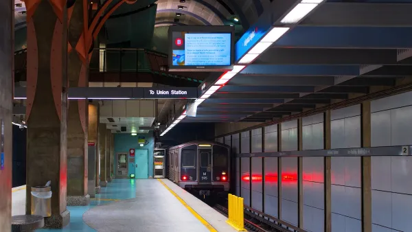
“A City of Neighborhoods,” a new exhibit at the Boston Public Library, uses maps to illustrate how waves of immigration shaped the city and its neighborhoods throughout the 20th century.
Greg Miller provides a preview of a new exhibition at the Boston Public Library called “A City of Neighborhoods.” “The idea is to look at Boston as a whole, but then to zero in on certain neighborhoods and see what those stories are,” says Michelle LeBlanc, director of education at the library’s Norman B. Leventhal Map Center, when quoted in the article.
Immigration has driven many of Boston’s population trends in the past century. Here Miller describes some of the population changes, and how some Boston neighborhoods remain diverse: “The percentage of foreign-born residents is lower than it used to be: 27 percent, compared to 36 percent in 1910. But some neighborhoods are still remarkably diverse. East Boston’s population is almost 50 percent foreign born, the highest percentage of any neighborhood in the city.”
As for an example of a neighborhood that has experienced immigration-driven changes: “The exhibit includes a brochure from 1910 advertising a new planned neighborhood, ‘Orient Heights,’ built on landfill [an] area of East Boston that was once covered by marshland. ‘They were trying to entice immigrant families from the slums of the West End and North End because there’s open space and fresh air and all that,’ LeBlanc said. Contrary to the development’s name, LeBlanc says the biggest immigrant groups at that time were Italians and Eastern European Jews. Today the biggest immigrant groups in the neighborhood are from El Salvador and Columbia.”
The exhibition stays away, however, from the touchy political subject of gentrification.
FULL STORY: Maps Reveal How Immigration Transformed Boston’s Neighborhoods

LA Transit Ridership Plummets Amidst ICE Raids
LA Metro’s bus and rail lines are seeing up to 15 percent lower ridership in the wake of violent immigration arrests.

Duffy Threatens to Cut DOT Funds to “Sanctuary Cities”
“Follow the law or forfeit the funding” says US Secretary of Transportation.
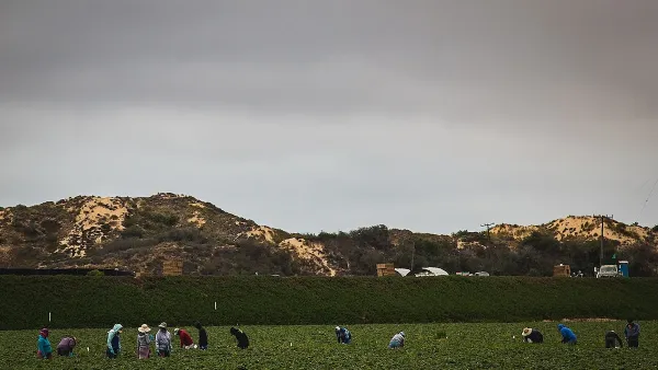
Without International Immigrants, the Rural US Population Would Be Falling 58%
Census data shows that population growth in rural areas is due in large part to international migrants.

Maui's Vacation Rental Debate Turns Ugly
Verbal attacks, misinformation campaigns and fistfights plague a high-stakes debate to convert thousands of vacation rentals into long-term housing.

Planetizen Federal Action Tracker
A weekly monitor of how Trump’s orders and actions are impacting planners and planning in America.

San Francisco Suspends Traffic Calming Amidst Record Deaths
Citing “a challenging fiscal landscape,” the city will cease the program on the heels of 42 traffic deaths, including 24 pedestrians.

Defunct Pittsburgh Power Plant to Become Residential Tower
A decommissioned steam heat plant will be redeveloped into almost 100 affordable housing units.

Trump Prompts Restructuring of Transportation Research Board in “Unprecedented Overreach”
The TRB has eliminated more than half of its committees including those focused on climate, equity, and cities.

Amtrak Rolls Out New Orleans to Alabama “Mardi Gras” Train
The new service will operate morning and evening departures between Mobile and New Orleans.
Urban Design for Planners 1: Software Tools
This six-course series explores essential urban design concepts using open source software and equips planners with the tools they need to participate fully in the urban design process.
Planning for Universal Design
Learn the tools for implementing Universal Design in planning regulations.
Heyer Gruel & Associates PA
JM Goldson LLC
Custer County Colorado
City of Camden Redevelopment Agency
City of Astoria
Transportation Research & Education Center (TREC) at Portland State University
Jefferson Parish Government
Camden Redevelopment Agency
City of Claremont