


Google's Advanced Technology And Projects (ATAP) group has released information about the new Project Tango—a mobile device that tracks 3D motion, using the data to map user environments.
“Most mobile devices today assume that the physical world ends at the boundaries of the screen,” says Johhny Lee, project lead at ATAP, in a YouTube video introducing Project Tango.
The goal of the Project Tango device, however, “is to give mobile devices a human scale understanding of space and motion,” says Lee.
Rodrigo Caula describes the technology in a designboom article, providing ample evidence of why this technology might be so important to planners and designers of the built environment: “the built-in sensors allow the phone to make over a quarter million three-dimensional measurements every second, updating its position and orientation in real-time, combining that data into a single 3D map of the space around you.”
FULL STORY: google introduces project tango, a smartphone that creates 3D environments


Gehry Partners Opens Up on Los Angeles River Progress
When Frank Gehry's involvement in the L.A. River restoration was announced in August 2015, the firm had already been conducting research on the project for nearly a year. For some time after that, details were scant and speculation abounded.
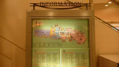
The Future of Mapping is Going Indoors
Cartographers have a new world to map, as technology opens up the interiors of malls, museums, and other large spaces to online exploration.
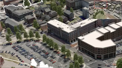
A Small Town's Game-Changing Approach to Mapping
Portsmoth, New Hampshire has created textured, 3D maps of its historic district to help illustrate development impacts during the approval process.

Maui's Vacation Rental Debate Turns Ugly
Verbal attacks, misinformation campaigns and fistfights plague a high-stakes debate to convert thousands of vacation rentals into long-term housing.

Planetizen Federal Action Tracker
A weekly monitor of how Trump’s orders and actions are impacting planners and planning in America.

In Urban Planning, AI Prompting Could be the New Design Thinking
Creativity has long been key to great urban design. What if we see AI as our new creative partner?

King County Supportive Housing Program Offers Hope for Unhoused Residents
The county is taking a ‘Housing First’ approach that prioritizes getting people into housing, then offering wraparound supportive services.

Researchers Use AI to Get Clearer Picture of US Housing
Analysts are using artificial intelligence to supercharge their research by allowing them to comb through data faster. Though these AI tools can be error prone, they save time and housing researchers are optimistic about the future.

Making Shared Micromobility More Inclusive
Cities and shared mobility system operators can do more to include people with disabilities in planning and operations, per a new report.
Urban Design for Planners 1: Software Tools
This six-course series explores essential urban design concepts using open source software and equips planners with the tools they need to participate fully in the urban design process.
Planning for Universal Design
Learn the tools for implementing Universal Design in planning regulations.
planning NEXT
Appalachian Highlands Housing Partners
Mpact (founded as Rail~Volution)
City of Camden Redevelopment Agency
City of Astoria
City of Portland
City of Laramie