


The USA Today takes a closer look at data from the recent “Has Motorization in the U.S. Peaked?” report by Michael Sivak for the University of Michigan Transportation Research Institute.

The “Has Motorization in the U.S. Peaked?” report confirmed the suspicions of many observers that Americans are driving less and own fewer cars and, as a result, attracted plenty of media attention.
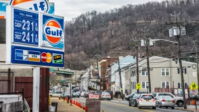
With a little more time to analyze the report, Alexander E.M. Hess and Thomas Frohlich recently drilled down on the factors contributing to the choice of more Americans to go without cars—especially in the five cities with lowest rates of car ownership (New York City, Washington D.C., Boston, Philadelphia, and San Francisco).
For one: “The five cities with the highest proportions of households without a vehicle were all among the top five cities in a recent ranking of the quality of public transportation," according to the WalkScore metric.
The article includes a break down of the mix of options and environmental factors that contribute to the low car ownership rates in the “cities where no one wants to drive.”
FULL STORY: Cities where no one wants to drive

Rise in Car-Free Households Supports "Peak Car" Arguments
After peaking in 2007, new research shows that the rate of vehicle ownership in the U.S. took a dive over the next five years. Researchers argue the growth in car-free households suggests the country has surpassed peak motorization.
Mid-Sized Cities Make Car-Free Gains
Several cities located in the Northeast, especially in the New York region, saw a significant increase in the number of car-free households.
Millennials Leading a Decline in Car Ownership in Some U.S. Cities
The young and the recently arrived in Seattle are less and less likely to own a car, according to new Seattle Times analysis of Census data.

Maui's Vacation Rental Debate Turns Ugly
Verbal attacks, misinformation campaigns and fistfights plague a high-stakes debate to convert thousands of vacation rentals into long-term housing.

Planetizen Federal Action Tracker
A weekly monitor of how Trump’s orders and actions are impacting planners and planning in America.

Chicago’s Ghost Rails
Just beneath the surface of the modern city lie the remnants of its expansive early 20th-century streetcar system.

Bend, Oregon Zoning Reforms Prioritize Small-Scale Housing
The city altered its zoning code to allow multi-family housing and eliminated parking mandates citywide.

Amtrak Cutting Jobs, Funding to High-Speed Rail
The agency plans to cut 10 percent of its workforce and has confirmed it will not fund new high-speed rail projects.

LA Denies Basic Services to Unhoused Residents
The city has repeatedly failed to respond to requests for trash pickup at encampment sites, and eliminated a program that provided mobile showers and toilets.
Urban Design for Planners 1: Software Tools
This six-course series explores essential urban design concepts using open source software and equips planners with the tools they need to participate fully in the urban design process.
Planning for Universal Design
Learn the tools for implementing Universal Design in planning regulations.
planning NEXT
Appalachian Highlands Housing Partners
Mpact (founded as Rail~Volution)
City of Camden Redevelopment Agency
City of Astoria
City of Portland
City of Laramie