An interview with Thomas Balsley, landscape architect and designer of hundreds of parks and plazas in New York, reveals inside baseball about the evolution of park design, planning, and approvals in the Big Apple.

In an interview with Jared Green, Thomas Balsley, FASLA, who has designed open spaces like Hunter’s Point South, Gantry Plaza State Park, and Heritage Field at Yankee Stadium in his role as the founder and principal of Thomas Balsley Associates reveals some of the critical junctures for the always fraught process of designing public space in New York City:
Balsley’s take on NYC’s evolution away from a period of stagnation and conservative design ethos: “It’s hard for people to imagine now, but 30 years ago, NYC was probably one of the most conservative places to practice the art of landscape architecture in the country. During that same period you couldn’t have found a notable building being built in New York City either. The city had horrible fiscal and safety troubles, which made it very conservative and fearful. There just wasn’t the courage or the will on the private or the public side to go out and take chances.”
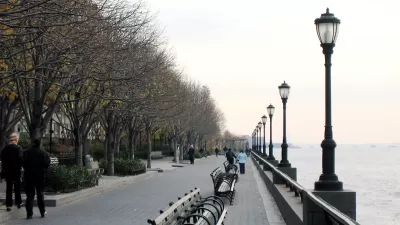
“Well, something happened 30 years ago, not with public money, but over at Battery Park City. It was a new model of urban planning. The developers were ingenious in securing public approvals. Battery Park introduced the notion that you can build parks first and then develop the parcels. To get this approach approved, the designers strategically harked back to New York at the turn of the century. The character of a park promised New Yorkers wouldn’t be controversial. Everyone said, ‘Oh, that’s great. We like that period.’… When it was built, Battery Park was pointed to as the great urban waterfront success and the ‘latest and the greatest’ of waterfront park design.
Balsley’s firm has also designed numerous privately owned public spaces (POPS), which gained national attention during the Occupy Wall Street protests of 2012. Here’s Balsley’s insight on how POPS have been designed in New York: “POPS used to be called bonus plazas. Plazas have been stigmatized as the receptors of all of society’s misfits and ills, so it’s no surprise that our profession hasn’t embraced them. NYC POPS were considered “dirty,” because you were doing work for developers, not the public sector. Until recently, NYC landscape architects treated them like they are lepers. They didn't want anything to do with them. As a result, some 95 percent of POPS in New York City are designed by architects. Taken together, there are 84 acres of POPS in Manhattan alone.”
FULL STORY: Q&A: Thomas Balsley, Landscape Architect

Planetizen Federal Action Tracker
A weekly monitor of how Trump’s orders and actions are impacting planners and planning in America.

Maui's Vacation Rental Debate Turns Ugly
Verbal attacks, misinformation campaigns and fistfights plague a high-stakes debate to convert thousands of vacation rentals into long-term housing.

San Francisco Suspends Traffic Calming Amidst Record Deaths
Citing “a challenging fiscal landscape,” the city will cease the program on the heels of 42 traffic deaths, including 24 pedestrians.

Defunct Pittsburgh Power Plant to Become Residential Tower
A decommissioned steam heat plant will be redeveloped into almost 100 affordable housing units.

Trump Prompts Restructuring of Transportation Research Board in “Unprecedented Overreach”
The TRB has eliminated more than half of its committees including those focused on climate, equity, and cities.

Amtrak Rolls Out New Orleans to Alabama “Mardi Gras” Train
The new service will operate morning and evening departures between Mobile and New Orleans.
Urban Design for Planners 1: Software Tools
This six-course series explores essential urban design concepts using open source software and equips planners with the tools they need to participate fully in the urban design process.
Planning for Universal Design
Learn the tools for implementing Universal Design in planning regulations.
Heyer Gruel & Associates PA
JM Goldson LLC
Custer County Colorado
City of Camden Redevelopment Agency
City of Astoria
Transportation Research & Education Center (TREC) at Portland State University
Jefferson Parish Government
Camden Redevelopment Agency
City of Claremont


