


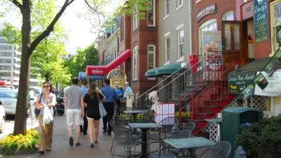
Walk Score has released its 2014 ranking of Most Walkable U.S. Cities and Neighborhoods. Though New York's position at the top of the list would be easy to explain, one surprise made the top five.
With walkability an increasingly important factor in where we chose to live, Walk Score's comprehensive evaluation of America's most pedestrian-friendly neighborhoods seems to only become more meaningful.
“For decades, Americans have tended to drive more every year, but that’s changing. Today commuting by bus, bike and foot are on the rise as more people choose apartments and homes in walkable neighborhoods and with shorter, cheaper and happier commutes,” said Josh Herst, CEO of Walk Score.
This year's top five cities are: New York, San Francisco, Boston, Philadelphia, and (perhaps surprisingly) Miami.
"The 2014 ranking of Most Walkable U.S. Cities and Neighborhoods is based on a proprietary algorithm and analysis of over 10 million addresses and over 2 billion walking routes to neighborhood amenities across 2,500 cities and more than 10,000 neighborhoods," says the company. "Walk Score’s ranking is the only national, quantitative walkability rating."
FULL STORY: 2014 Ranking of Most Walkable Cities & Neighborhoods

New Tool for Measuring Neighborhood Walkability
Watch out Walk Score, you've got some competition. Mapping company Maponics is measuring pedestrian-friendliness with a new tool called 'Walkability'. They measure several factors Walk Score doesn't, including crime, street type, and speed limit.

What the ‘Walk Score’ Misses
A popular walkability assessment omits key factors that impact different demographics and can direct development resources to already wealthy neighborhoods.
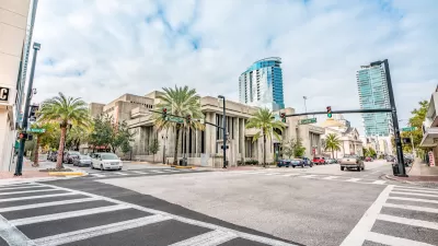
Orlando Pledges to Improve Walkability
A city report highlights successes and failures in building safer transportation infrastructure and reducing VMT in 2023.

Maui's Vacation Rental Debate Turns Ugly
Verbal attacks, misinformation campaigns and fistfights plague a high-stakes debate to convert thousands of vacation rentals into long-term housing.

Planetizen Federal Action Tracker
A weekly monitor of how Trump’s orders and actions are impacting planners and planning in America.

San Francisco Suspends Traffic Calming Amidst Record Deaths
Citing “a challenging fiscal landscape,” the city will cease the program on the heels of 42 traffic deaths, including 24 pedestrians.

Defunct Pittsburgh Power Plant to Become Residential Tower
A decommissioned steam heat plant will be redeveloped into almost 100 affordable housing units.

Trump Prompts Restructuring of Transportation Research Board in “Unprecedented Overreach”
The TRB has eliminated more than half of its committees including those focused on climate, equity, and cities.

Amtrak Rolls Out New Orleans to Alabama “Mardi Gras” Train
The new service will operate morning and evening departures between Mobile and New Orleans.
Urban Design for Planners 1: Software Tools
This six-course series explores essential urban design concepts using open source software and equips planners with the tools they need to participate fully in the urban design process.
Planning for Universal Design
Learn the tools for implementing Universal Design in planning regulations.
Heyer Gruel & Associates PA
JM Goldson LLC
Custer County Colorado
City of Camden Redevelopment Agency
City of Astoria
Transportation Research & Education Center (TREC) at Portland State University
Jefferson Parish Government
Camden Redevelopment Agency
City of Claremont