


Watch out Walk Score, you've got some competition. Mapping company Maponics is measuring pedestrian-friendliness with a new tool called 'Walkability'. They measure several factors Walk Score doesn't, including crime, street type, and speed limit.

"With its newest tool, Maponics measures walkability in three categories: overall walkability, proximity to amenities (i.e. shopping centers, dry cleaners), and proximity to leisure (i.e. social and cultural options)," explains Ariel Schwartz. "When considering walkability, the company runs simulations through the road network to figure out how walkers get where they want to go. 'It's not just a matter of measuring proximity. It's accessibility. Can you get to places, or do you need to cross highway?' says [CEO Darrin] Clement. 'It's no good if there are multiple complex intersections.'"
"This isn't a consumer-facing tool," notes Schwartz, "but you might have access to it through other services. The tool is geared in particular towards the real estate space, where perceptions about modes of transportation and access to amenities affects where people want to live as well as home prices."
FULL STORY: How Walkable Is Your Neighborhood? This Mapping Data Juggernaut Now Knows

Is Your City One of America's Most Walkable?
Walk Score has released its 2014 ranking of Most Walkable U.S. Cities and Neighborhoods. Though New York's position at the top of the list would be easy to explain, one surprise made the top five.

What the ‘Walk Score’ Misses
A popular walkability assessment omits key factors that impact different demographics and can direct development resources to already wealthy neighborhoods.
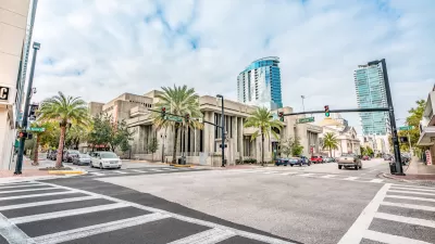
Orlando Pledges to Improve Walkability
A city report highlights successes and failures in building safer transportation infrastructure and reducing VMT in 2023.

Maui's Vacation Rental Debate Turns Ugly
Verbal attacks, misinformation campaigns and fistfights plague a high-stakes debate to convert thousands of vacation rentals into long-term housing.

Planetizen Federal Action Tracker
A weekly monitor of how Trump’s orders and actions are impacting planners and planning in America.

Chicago’s Ghost Rails
Just beneath the surface of the modern city lie the remnants of its expansive early 20th-century streetcar system.

Bend, Oregon Zoning Reforms Prioritize Small-Scale Housing
The city altered its zoning code to allow multi-family housing and eliminated parking mandates citywide.

Amtrak Cutting Jobs, Funding to High-Speed Rail
The agency plans to cut 10 percent of its workforce and has confirmed it will not fund new high-speed rail projects.

LA Denies Basic Services to Unhoused Residents
The city has repeatedly failed to respond to requests for trash pickup at encampment sites, and eliminated a program that provided mobile showers and toilets.
Urban Design for Planners 1: Software Tools
This six-course series explores essential urban design concepts using open source software and equips planners with the tools they need to participate fully in the urban design process.
Planning for Universal Design
Learn the tools for implementing Universal Design in planning regulations.
planning NEXT
Appalachian Highlands Housing Partners
Mpact (founded as Rail~Volution)
City of Camden Redevelopment Agency
City of Astoria
City of Portland
City of Laramie