


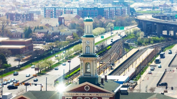
New development is poised to add thousands of riders to D.C.'s Metro, but rush hour trains are often packed already. Though Metro has proposed $6 billion in fixes, some see better land use planning across the area as the key to solving the problem.

"Since the recession, real estate developers have been gobbling up Metro-accessible land and planning and building offices and apartments from Reston to New Carrollton," writes Jonathan O'Connell. "This building renaissance will add thousands of new riders to the Metro system’s already overwhelmed tracks. Stemming the overflow may require not just changes to the system but to how the region makes land use decisions."
"Metro has unveiled $6 billion worth of improvements it says are needed by 2025, among them increasing trains from six to eight cars ($2 billion), redesigning track connections or adding a new station in Rosslyn ($1 billion) and adding pedestrian tunnels connecting Metro Center to Gallery Place and Farragut North to Farragut West ($1 billion)," notes O'Connell.
But Ron Kirby, director of transportation planning at the Metropolitan Washington Council of Governments, thinks that better balancing land use across the system is important to addressing overcrowding. "That requires Metro, local governments and the private sector coordinating their visions, but it’s far cheaper than adding new lines or stations: 'A lot of what we need to do with the Metrorail challenge is shape the demand.'”
FULL STORY: As D.C. area developers gobble up land, Metro system poised to become more overwhelmed

Maryland Awards $1.25M in TOD-Related Grants
The state’s DOT is funding projects that prepare sites around transit stations for future mixed-use development and housing.
Judge Rules in Favor of Massachusetts TOD Law
The court rejected an argument that the MBTA Communities law, which requires zoning for multifamily housing, is an “unfunded mandate.”

DARTSpace Platform Streamlines Dallas TOD Application Process
The Dallas transit agency hopes a shorter permitting timeline will boost transit-oriented development around rail stations.

Maui's Vacation Rental Debate Turns Ugly
Verbal attacks, misinformation campaigns and fistfights plague a high-stakes debate to convert thousands of vacation rentals into long-term housing.

Planetizen Federal Action Tracker
A weekly monitor of how Trump’s orders and actions are impacting planners and planning in America.

In Urban Planning, AI Prompting Could be the New Design Thinking
Creativity has long been key to great urban design. What if we see AI as our new creative partner?

King County Supportive Housing Program Offers Hope for Unhoused Residents
The county is taking a ‘Housing First’ approach that prioritizes getting people into housing, then offering wraparound supportive services.

Researchers Use AI to Get Clearer Picture of US Housing
Analysts are using artificial intelligence to supercharge their research by allowing them to comb through data faster. Though these AI tools can be error prone, they save time and housing researchers are optimistic about the future.

Making Shared Micromobility More Inclusive
Cities and shared mobility system operators can do more to include people with disabilities in planning and operations, per a new report.
Urban Design for Planners 1: Software Tools
This six-course series explores essential urban design concepts using open source software and equips planners with the tools they need to participate fully in the urban design process.
Planning for Universal Design
Learn the tools for implementing Universal Design in planning regulations.
planning NEXT
Appalachian Highlands Housing Partners
Mpact (founded as Rail~Volution)
City of Camden Redevelopment Agency
City of Astoria
City of Portland
City of Laramie