


A new study has quantified how Baron Georges-Eugene Haussmann's plans changed the form and function of Paris - a topic that had previously been open to the subjective analysis of urban theorists. The results might surprise you.
"[A] new study by a collaboration of mathematical physicists and social historians in France shows that, simply by analysing old and new maps of the city, it’s possible to quantify what effect Haussmann’s plans had on the shape and life of Paris," reports Philip Ball. "The results offer a case history of how cities may evolve through a combination of spontaneous self-organisation and top-down central planning."
"Marc Barthelemy of the CEA Institute of Theoretical Physics in the Parisian suburb of Gif-sur-Yvette and his colleagues have analysed maps of the city road network at six moments in time since the Revolution began: 1789, 1826, 1836, 1888, 1999 and 2010. They looked at some basic properties of the networks, such as the numbers of nodes (intersections) and edges (roads between intersections), as well as using more sophisticated concepts from the modern theory of complex networks, such as the quantity called 'betweenness centrality' (BC) that measures the importance of individual nodes to navigating the network."
"The results are revealing," says Ball. "Whether or not Haussmann made a difference depends on what you look at."
FULL STORY: The revolution that built the streets of Paris


France Tightens Restrictions on Short-Term Rentals
The vacation rental market is shouldering part of the blame for rising housing costs, particularly in popular tourist destinations.
Eurostar Temporarily Closing Two High-Speed Rail Routes
Eurostar is temporarily closing routes from London to Disneyland Paris and London to Amsterdam.
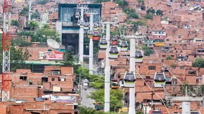
Paris Approves First Aerial Gondola
An aerial tramway project in the French capital cleared feasibility studies and could open in 2025.

Maui's Vacation Rental Debate Turns Ugly
Verbal attacks, misinformation campaigns and fistfights plague a high-stakes debate to convert thousands of vacation rentals into long-term housing.

Planetizen Federal Action Tracker
A weekly monitor of how Trump’s orders and actions are impacting planners and planning in America.

San Francisco Suspends Traffic Calming Amidst Record Deaths
Citing “a challenging fiscal landscape,” the city will cease the program on the heels of 42 traffic deaths, including 24 pedestrians.

Defunct Pittsburgh Power Plant to Become Residential Tower
A decommissioned steam heat plant will be redeveloped into almost 100 affordable housing units.

Trump Prompts Restructuring of Transportation Research Board in “Unprecedented Overreach”
The TRB has eliminated more than half of its committees including those focused on climate, equity, and cities.

Amtrak Rolls Out New Orleans to Alabama “Mardi Gras” Train
The new service will operate morning and evening departures between Mobile and New Orleans.
Urban Design for Planners 1: Software Tools
This six-course series explores essential urban design concepts using open source software and equips planners with the tools they need to participate fully in the urban design process.
Planning for Universal Design
Learn the tools for implementing Universal Design in planning regulations.
Heyer Gruel & Associates PA
JM Goldson LLC
Custer County Colorado
City of Camden Redevelopment Agency
City of Astoria
Transportation Research & Education Center (TREC) at Portland State University
Jefferson Parish Government
Camden Redevelopment Agency
City of Claremont