


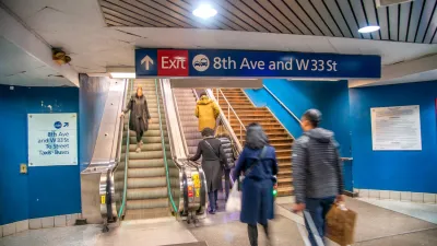
After the World Trade Center attacks, planners, neighbors, and Mayor Bloomberg supported reweaving the site into the city's street grid, in the process undoing "a painful planning error of the 1960s." Security concerns seem to have won out, however.
"With the blank slate offered by a catastrophic attack, planners, soon joined by the mayor himself, saw a chance to re-establish a great crossroads in the middle of ground zero: Fulton and Greenwich Streets, tying the second World Trade Center into the city — north, south, east and west," writes David W. Dunlap. "Now, however, they see that vision slipping away, as security concerns trump urban planning."
"The Police Department has proposed encircling the site with a fortified palisade of guard booths, vehicle barricades and sidewalk barriers," he explains.
“The argument that these measures will disconnect the site from the rest of Lower Manhattan ignores the fact that people largely experience the city on foot and on bikes,” said Richard C. Daddario, the deputy police commissioner for counterterrorism, in defending the plan. “The measure of connectiveness should not be the volume of vehicle traffic passing through the site.”
FULL STORY: World Trade Center May Be Isolated Again, This Time by Security Measures

In Both Crashes and Crime, Public Transportation is Far Safer than Driving
Contrary to popular assumptions, public transportation has far lower crash and crime rates than automobile travel. For safer communities, improve and encourage transit travel.

Building Secure Yet Welcoming Public Spaces
Strategies for securing public spaces from vehicle attacks and other acts of terrorism without sacrificing accessible, vibrant urban places.
The Link Between Urban Design and Crime
A meta-study shows that public realm interventions can help reduce crime rates.

Maui's Vacation Rental Debate Turns Ugly
Verbal attacks, misinformation campaigns and fistfights plague a high-stakes debate to convert thousands of vacation rentals into long-term housing.

Planetizen Federal Action Tracker
A weekly monitor of how Trump’s orders and actions are impacting planners and planning in America.

San Francisco Suspends Traffic Calming Amidst Record Deaths
Citing “a challenging fiscal landscape,” the city will cease the program on the heels of 42 traffic deaths, including 24 pedestrians.

Defunct Pittsburgh Power Plant to Become Residential Tower
A decommissioned steam heat plant will be redeveloped into almost 100 affordable housing units.

Trump Prompts Restructuring of Transportation Research Board in “Unprecedented Overreach”
The TRB has eliminated more than half of its committees including those focused on climate, equity, and cities.

Amtrak Rolls Out New Orleans to Alabama “Mardi Gras” Train
The new service will operate morning and evening departures between Mobile and New Orleans.
Urban Design for Planners 1: Software Tools
This six-course series explores essential urban design concepts using open source software and equips planners with the tools they need to participate fully in the urban design process.
Planning for Universal Design
Learn the tools for implementing Universal Design in planning regulations.
Heyer Gruel & Associates PA
JM Goldson LLC
Custer County Colorado
City of Camden Redevelopment Agency
City of Astoria
Transportation Research & Education Center (TREC) at Portland State University
Jefferson Parish Government
Camden Redevelopment Agency
City of Claremont