


A private collection of 38,000 historical maps has been added to the Digital Public Library of America, reports Rebecca Rosen, making it more accessible to researchers and anyone interested in the history of their community.
"More than three decades ago, David Rumsey began building a map collection. By the mid-90s he had thousands and thousands of maps to call his own -- and his alone. He wanted to share them with the public."
"Bit by bit, Rumsey digitized his collection -- up to 38,000 maps and other items-- along the way developing software that made it easier for people to explore the maps and 3D objects such as globes online. Today, the Digital Public Library of America announced that Rumsey's collection would now be available through the DPLA portal, placing the maps into the deeper and broader context of the DPLA's other holdings."
FULL STORY: Oh the Places You'll Go: 38,000 Historical Maps to Explore at New Online Library

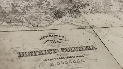
USGS Map Archive Now Easily Accessible
The U.S. Geological Survey has introduced topoView, an intuitive map-based tool making it far simpler to search and access its archive of 178,000 topographical maps dating from 1880 to 2010.

Interactive Map Reveals America's “Shade Deserts”
Launched by UCLA and American Forests to combat heat-related deaths, the tool maps the shade infrastructure for over 360 U.S. cities.

Maps: How Much of Your City is Parking?
The percentage of land dedicated to parking in the central districts of major U.S. cities ranges from 4 percent to as much as 42 percent.

Maui's Vacation Rental Debate Turns Ugly
Verbal attacks, misinformation campaigns and fistfights plague a high-stakes debate to convert thousands of vacation rentals into long-term housing.

Planetizen Federal Action Tracker
A weekly monitor of how Trump’s orders and actions are impacting planners and planning in America.

In Urban Planning, AI Prompting Could be the New Design Thinking
Creativity has long been key to great urban design. What if we see AI as our new creative partner?

King County Supportive Housing Program Offers Hope for Unhoused Residents
The county is taking a ‘Housing First’ approach that prioritizes getting people into housing, then offering wraparound supportive services.

Researchers Use AI to Get Clearer Picture of US Housing
Analysts are using artificial intelligence to supercharge their research by allowing them to comb through data faster. Though these AI tools can be error prone, they save time and housing researchers are optimistic about the future.

Making Shared Micromobility More Inclusive
Cities and shared mobility system operators can do more to include people with disabilities in planning and operations, per a new report.
Urban Design for Planners 1: Software Tools
This six-course series explores essential urban design concepts using open source software and equips planners with the tools they need to participate fully in the urban design process.
Planning for Universal Design
Learn the tools for implementing Universal Design in planning regulations.
planning NEXT
Appalachian Highlands Housing Partners
Mpact (founded as Rail~Volution)
City of Camden Redevelopment Agency
City of Astoria
City of Portland
City of Laramie