


To the surprise of many, a change in governments has failed to derail former president Nicolas Sarkozy's ambitious "Greater Paris" plan for an expanded transit network linking the French capital to its suburbs.
"The French government has approved an ambitious plan to extend Paris into the suburbs after months of speculation it would abandon the project," reports Kim Willsher. "The prime minister, Jean-Marc Ayrault, said a massive new transport network that would link major banlieues to the capital – a key element of the scheme for a 'Greater Paris' – had been given the go ahead despite a massive increase in costs."
"Central to the plans is a high-speed transit network known as the 'super metro' with 125 miles of new lines and 72 new stations, linking key suburbs and airports," explains Willsher. "Billions more will be spent on improving and extending existing metro lines."
"Ayrault said the scheme, originally launched by the former president Nicolas Sarkozy in 2007, showed 'unprecedented ambition' and should be completed by 2030, five years later than planned. He admitted it would cost far above the original €20.5bn (£17.8bn) budget, but insisted the money would be found."
"It needs this investment, which will be of benefit, directly and indirectly, to the whole country," Ayrault said.
FULL STORY: Sarkozy 'Greater Paris' plan given go-ahead by French government

Complaints Grow Over Increasing "Ugliness" of Paris
A press conference was held in Paris to draw attention to the problem of "increasingly large and unsympathetic buildings" cropping up around the City of Lights.

France Tightens Restrictions on Short-Term Rentals
The vacation rental market is shouldering part of the blame for rising housing costs, particularly in popular tourist destinations.
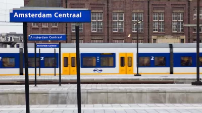
Eurostar Temporarily Closing Two High-Speed Rail Routes
Eurostar is temporarily closing routes from London to Disneyland Paris and London to Amsterdam.

Maui's Vacation Rental Debate Turns Ugly
Verbal attacks, misinformation campaigns and fistfights plague a high-stakes debate to convert thousands of vacation rentals into long-term housing.

Planetizen Federal Action Tracker
A weekly monitor of how Trump’s orders and actions are impacting planners and planning in America.

In Urban Planning, AI Prompting Could be the New Design Thinking
Creativity has long been key to great urban design. What if we see AI as our new creative partner?

King County Supportive Housing Program Offers Hope for Unhoused Residents
The county is taking a ‘Housing First’ approach that prioritizes getting people into housing, then offering wraparound supportive services.

Researchers Use AI to Get Clearer Picture of US Housing
Analysts are using artificial intelligence to supercharge their research by allowing them to comb through data faster. Though these AI tools can be error prone, they save time and housing researchers are optimistic about the future.

Making Shared Micromobility More Inclusive
Cities and shared mobility system operators can do more to include people with disabilities in planning and operations, per a new report.
Urban Design for Planners 1: Software Tools
This six-course series explores essential urban design concepts using open source software and equips planners with the tools they need to participate fully in the urban design process.
Planning for Universal Design
Learn the tools for implementing Universal Design in planning regulations.
planning NEXT
Appalachian Highlands Housing Partners
Mpact (founded as Rail~Volution)
City of Camden Redevelopment Agency
City of Astoria
City of Portland
City of Laramie