


Marcus Tudehope offers 12 reasons why community-led counting and mapping of the urban poor can be an effective tool for putting "power and democracy" into their hands.
"Enumeration: to be counted; it is the fundamental basis of inclusion in the city," argues Tudehope. "To exclude a community from census and mapping activities is to effectively render it invisible to urban decision-making processes. But as the world urbanises, an ever-increasing proportion of humanity is coming to reside in urban poor settlements, outside the scope of most traditional methods of enumeration such as government censuses which underpin land management and urban planning."
"In settings where the capacity or will to include the urban poor in official mapping and enumeration activities is lacking, participatory, community-led processes frequently come to occupy the void," he explains. "Following the seminal work of SPARC India's We the invisible, its 1985 census of pavement dwellers in Mumbai, the concept has gained international recognition and is now widely practiced throughout the developing world. However, community maps and data are not ends in themselves, but they can form vital steps in the larger process of creating more inclusive cities."
Tudehope goes on to explore 12 reasons - from increasing tenure security to countering misinformation campaigns - why community-based census and mapping activities can "assist the urban poor in staking their claim to a place in the city."
FULL STORY: Mapping the urban poor: 12 reasons why you should conduct enumerations of your settlements

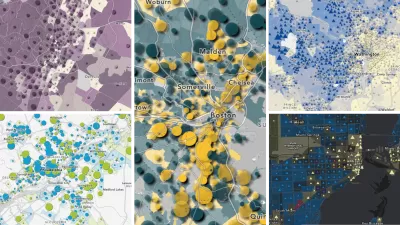
How Prisoners Skew the Census
At Census time, America's prisoners have typically been counted as residents of the places they are imprisoned. But with nearly 1% of the U.S. population behind bars, where they're counted is counting more to the urban areas they came from.

Trump Cuts Decimate Mapping Agency
The National Geodetic Survey maintains and updates critical spatial reference systems used extensively in both the public and private sectors.
Explore US Demographics With the New ACS Atlas Collection
Esri's new ACS Atlas Collection offers interactive applications that visualize the latest U.S. demographic and socio-economic data, enabling users to explore over 175 curated web maps across various thematic areas.

Maui's Vacation Rental Debate Turns Ugly
Verbal attacks, misinformation campaigns and fistfights plague a high-stakes debate to convert thousands of vacation rentals into long-term housing.

Planetizen Federal Action Tracker
A weekly monitor of how Trump’s orders and actions are impacting planners and planning in America.

In Urban Planning, AI Prompting Could be the New Design Thinking
Creativity has long been key to great urban design. What if we see AI as our new creative partner?

King County Supportive Housing Program Offers Hope for Unhoused Residents
The county is taking a ‘Housing First’ approach that prioritizes getting people into housing, then offering wraparound supportive services.

Researchers Use AI to Get Clearer Picture of US Housing
Analysts are using artificial intelligence to supercharge their research by allowing them to comb through data faster. Though these AI tools can be error prone, they save time and housing researchers are optimistic about the future.

Making Shared Micromobility More Inclusive
Cities and shared mobility system operators can do more to include people with disabilities in planning and operations, per a new report.
Urban Design for Planners 1: Software Tools
This six-course series explores essential urban design concepts using open source software and equips planners with the tools they need to participate fully in the urban design process.
Planning for Universal Design
Learn the tools for implementing Universal Design in planning regulations.
planning NEXT
Appalachian Highlands Housing Partners
Mpact (founded as Rail~Volution)
City of Camden Redevelopment Agency
City of Astoria
City of Portland
City of Laramie