


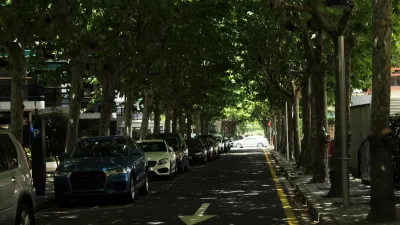
Want to know how many people drive in your city? The answers are easy to find. But for anyone trying to find out how many people bike and walk, it's not so easy. The result is problematic for safety and spending advocates alike. This may soon change.
“The current state of bike/ped counts is way behind where it should be,” said Darren Flusche, policy director at the League of American Bicyclists. “We know a lot about how to count cars but not a lot about how to count bikes.”
So why is it a big deal that data collection on walking and biking is less rigorous than for other modes?
For one, look at the recent traffic fatality findings. While auto deaths have seen a steep decline of late, pedestrian and bike fatalities are up. Is this the result of more pedestrians and bicyclists on the streets, or is something more insidious to blame? With a lack of sound data, experts can only speculate.
"Better measurement tools are especially important because the new transportation bill, MAP-21, emphasizes 'performance measures' in selecting projects for federal funding," notes Schmitt. "Having a weak sense of how many people are actually biking and walking makes it difficult to build a strong, data-based case for increased investment in infrastructure to support those activities."
“We live in a world where our decisions are increasingly based on data,” Flusche said. “If you don’t have good data, you can’t make good decisions.”
Thankfully, reports Schmitt, "[t]he state of bike/ped data may soon improve. For the first time this year, the Federal Highway Administration has issued recommendations for “non-motorized” groups in its Traffic Monitoring Guide [PDF]. States and localities still have to want to collect data — there’s no one forcing them to do it — but this will be the first time that the 'bible' for traffic counts even contemplates cyclists and pedestrians in its guidance."
"The guide sets out to help agencies decide what method is best for their purposes: manual or automatic counters, long or short-term measurement periods, and so on. It also advises transportation professionals about how to interpret the data — which, given the limited information currently available, has been very difficult to do."
FULL STORY: Finally Getting Serious About Measuring How Much People Walk and Bike

Report: New Techniques and Technology for Monitoring Active Transportation
The growing popularity of active transportation requires planners and advocates to better survey how, where, and when people are biking and walking. A new study by the Transportation Research Board shares the cutting edge of survey techniques.
Research: More Complex Streets Are Safer
Streets that offer more perceived obstacles and distractions can force drivers to slow down and drive more carefully.

‘Complete Streets’ Webpage Deleted in Federal Purge
Basic resources and information on building bike lanes and sidewalks, formerly housed on the government’s Complete Streets website, are now gone.

Maui's Vacation Rental Debate Turns Ugly
Verbal attacks, misinformation campaigns and fistfights plague a high-stakes debate to convert thousands of vacation rentals into long-term housing.

Planetizen Federal Action Tracker
A weekly monitor of how Trump’s orders and actions are impacting planners and planning in America.

In Urban Planning, AI Prompting Could be the New Design Thinking
Creativity has long been key to great urban design. What if we see AI as our new creative partner?

King County Supportive Housing Program Offers Hope for Unhoused Residents
The county is taking a ‘Housing First’ approach that prioritizes getting people into housing, then offering wraparound supportive services.

Researchers Use AI to Get Clearer Picture of US Housing
Analysts are using artificial intelligence to supercharge their research by allowing them to comb through data faster. Though these AI tools can be error prone, they save time and housing researchers are optimistic about the future.

Making Shared Micromobility More Inclusive
Cities and shared mobility system operators can do more to include people with disabilities in planning and operations, per a new report.
Urban Design for Planners 1: Software Tools
This six-course series explores essential urban design concepts using open source software and equips planners with the tools they need to participate fully in the urban design process.
Planning for Universal Design
Learn the tools for implementing Universal Design in planning regulations.
planning NEXT
Appalachian Highlands Housing Partners
Mpact (founded as Rail~Volution)
City of Camden Redevelopment Agency
City of Astoria
City of Portland
City of Laramie