


Ever wonder how the greenhouse gas emissions of your home compare to your neighbor's, or the supermarket down the street, or the office tower you work in? New software helps visualize such information in three dimensions across an entire city.
Developed by researchers at Arizona State University, the Hestia Project makes dramatically clear the comparative greenhouse gas emissions of a city's energy users, "right down to its individual buildings and roadways," explains Emily Badger.
One of the project's key advances is that, "[t]he software corrals publicly available data wholly unrelated to climate
change. That includes property tax filings that reveal the size and age
of buildings, how they're used and what fuel heats them, DMV records on
auto maintenance and inspections, and Metropolitan Planning
Organization traffic count estimates."
"The researchers have begun to test the software in Phoenix and Los
Angeles as well," notes Badger, "and [Kevin Gurney, an associate professor in ASU's School of Life Sciences and a senior scientist with the Global Institute of Sustainability] imagines that it would be particularly
useful to city managers trying to figure out how to target limited
resources toward the emissions sources with the greatest potential for
reductions."
FULL STORY: Watch a City Aglow in Greenhouse Gas Emissions

The United Nations Studies Urban Emissions Monitoring
Urban emissions researchers have been invited to speak at the UN Climate Conference in Lima. Their findings: through focused and networked monitoring, cities can make real inroads on cutting carbon.
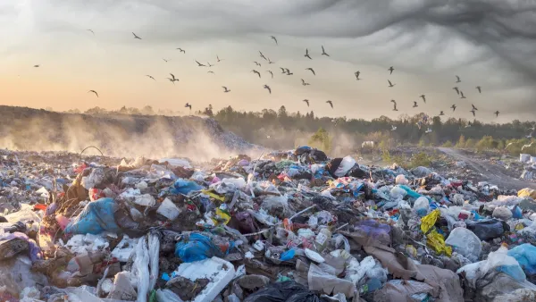
Colorado Landfills Emit as Much Pollution as 1M Cars
Landfills are the third-largest source of methane pollution in Colorado, after agriculture and fossil fuel extraction.

Indianapolis Advances Plans to Expand and Connect Citywide Greenway Network
Indianapolis is developing a new Greenways Strategic Implementation Plan to expand, connect, and modernize its trail system, aiming for over 250 miles of greenways that support sustainability, mobility, and community well-being.

Maui's Vacation Rental Debate Turns Ugly
Verbal attacks, misinformation campaigns and fistfights plague a high-stakes debate to convert thousands of vacation rentals into long-term housing.

Planetizen Federal Action Tracker
A weekly monitor of how Trump’s orders and actions are impacting planners and planning in America.

San Francisco Suspends Traffic Calming Amidst Record Deaths
Citing “a challenging fiscal landscape,” the city will cease the program on the heels of 42 traffic deaths, including 24 pedestrians.

Defunct Pittsburgh Power Plant to Become Residential Tower
A decommissioned steam heat plant will be redeveloped into almost 100 affordable housing units.

Trump Prompts Restructuring of Transportation Research Board in “Unprecedented Overreach”
The TRB has eliminated more than half of its committees including those focused on climate, equity, and cities.

Amtrak Rolls Out New Orleans to Alabama “Mardi Gras” Train
The new service will operate morning and evening departures between Mobile and New Orleans.
Urban Design for Planners 1: Software Tools
This six-course series explores essential urban design concepts using open source software and equips planners with the tools they need to participate fully in the urban design process.
Planning for Universal Design
Learn the tools for implementing Universal Design in planning regulations.
Heyer Gruel & Associates PA
JM Goldson LLC
Custer County Colorado
City of Camden Redevelopment Agency
City of Astoria
Transportation Research & Education Center (TREC) at Portland State University
Jefferson Parish Government
Camden Redevelopment Agency
City of Claremont