


As the level of golf participation falls, a new course is rising in a park in the Bronx with the assistance of $97 million in public funds. Is a notoriously expensive, and elitist, sport the best use of land in a borough with a 30% poverty rate?
The controversy over the construction of a golf course, to be operated by Trump National and International Golf Clubs no less, on a major portion of Ferry Point Park in the southeastern section of the Bronx is not new. But with its budget swelling and recent news about nefarious links to a contracting company the city is using on the project and elevated levels of methane gas found just outside the golf course's perimeter, the course controversy has roared back to life.
"[T]hese recent issues," says Ginia Bellafante, "would seem entirely peripheral to the more
essential question of whether spending tens of millions of dollars and
turning over acres and acres of land to a sport whose hourly caloric
expenditure falls short of considerably less expensive forms of exercise
- Ultimate Frisbee, for instance, or jogging - is really the maximally
efficient use of the city's resources."
"As it happens, the development of the course is causing Ferry Point Park
to stand as one of the more egregious symbols of class division in a
city already so famously replete with them."
FULL STORY: In the Bronx, Throwing $97 Million Down 18 Holes

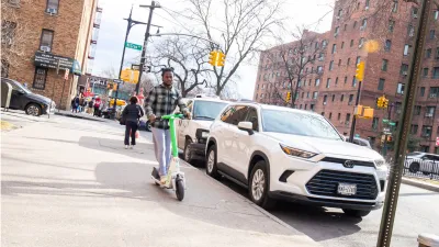
Last Mile: Micromobility in the Outer Reaches of NYC’s Outer Boroughs
In 2021 New York City rolled out an e-scooter program in some of the city’s most underserved transportation zones, focused on equity and access. Urban planner Thandi Nyambose gives an insider’s view of the program from the ground.

A Bronx Community Fights to Have its Voice Heard
After organizing and giving input for decades, the community around the Kingsbridge Armory might actually see it redeveloped — and they want to continue to have a say in how it goes.

NYC E-Scooter Program Threatened Despite High Ridership
Rental scooters in Queens and the Bronx provided close to two million trips in 2024, with many trips starting or ending near transit. Some city officials want to remove them.

Maui's Vacation Rental Debate Turns Ugly
Verbal attacks, misinformation campaigns and fistfights plague a high-stakes debate to convert thousands of vacation rentals into long-term housing.

Planetizen Federal Action Tracker
A weekly monitor of how Trump’s orders and actions are impacting planners and planning in America.

In Urban Planning, AI Prompting Could be the New Design Thinking
Creativity has long been key to great urban design. What if we see AI as our new creative partner?

Portland Raises Parking Fees to Pay for Street Maintenance
The city is struggling to bridge a massive budget gap at the Bureau of Transportation, which largely depleted its reserves during the Civd-19 pandemic.

Spokane Mayor Introduces Housing Reforms Package
Mayor Lisa Brown’s proposals include deferring or waiving some development fees to encourage more affordable housing development.

Houston Mayor Kills Another Bike Lane
The mayor rejected a proposed bike lane in the Montrose district in keeping with his pledge to maintain car lanes.
Urban Design for Planners 1: Software Tools
This six-course series explores essential urban design concepts using open source software and equips planners with the tools they need to participate fully in the urban design process.
Planning for Universal Design
Learn the tools for implementing Universal Design in planning regulations.
Gallatin County Department of Planning & Community Development
Heyer Gruel & Associates PA
JM Goldson LLC
City of Camden Redevelopment Agency
City of Astoria
Transportation Research & Education Center (TREC) at Portland State University
Jefferson Parish Government
Camden Redevelopment Agency
City of Claremont