


Going beyond the analytical parameters of the popular Walk Score website, a new site aims to broaden the scope of analysis to include more qualitative information, such as safety and streetscape, in determining which areas are pedestrian friendly.
As walkable urbanism emerges as a new paradigm in real estate development, and studies demonstrate the value of walkable places to economic and personal health, the marketplace for defining and rating places friendly to pedestrians is rapidly expanding. Ben Schiller profiles Walkonomics, a new site that aims to provide a new tool for measuring walkability by aiming to build "as comprehensive a picture as possible."
"Services such as Walk Score
already score proximity to restaurants and shops (and more); how long
your commute is; and allow you to compare areas. But, according to Adam
Davies [founder of the site], that's only part of the story of walkability. Ideally, you also
want to know things like how safe the streets are, whether the sidewalks
are wide enough, how clear the signage is, and also--less tangibly--how
clean the street is, and whether it's relaxing and fun. Distance, in
other words, is not the only factor--perhaps not even the most important
factor."
"Currently covering about 600,000 streets in the U.K. and U.S., the site
is based on a mixture of government-sourced open data, and crowd-sourced
information from users. Streets are scored across eight categories,
based on data like traffic activity and crime statistics. Users can then
give their own impressions, shifting the scores over time."
FULL STORY: A New Site Calculates Your Neighborhood’s Walkability


What the ‘Walk Score’ Misses
A popular walkability assessment omits key factors that impact different demographics and can direct development resources to already wealthy neighborhoods.
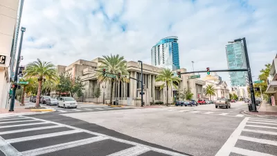
Orlando Pledges to Improve Walkability
A city report highlights successes and failures in building safer transportation infrastructure and reducing VMT in 2023.

Green Spaces Benefit Neighborhoods—When Residents can Reach Them
A study comparing green space and walkability scores found that, without effective access to local parks, residents of greener neighborhoods don’t reap the health benefits.

Maui's Vacation Rental Debate Turns Ugly
Verbal attacks, misinformation campaigns and fistfights plague a high-stakes debate to convert thousands of vacation rentals into long-term housing.

Planetizen Federal Action Tracker
A weekly monitor of how Trump’s orders and actions are impacting planners and planning in America.

In Urban Planning, AI Prompting Could be the New Design Thinking
Creativity has long been key to great urban design. What if we see AI as our new creative partner?

King County Supportive Housing Program Offers Hope for Unhoused Residents
The county is taking a ‘Housing First’ approach that prioritizes getting people into housing, then offering wraparound supportive services.

Researchers Use AI to Get Clearer Picture of US Housing
Analysts are using artificial intelligence to supercharge their research by allowing them to comb through data faster. Though these AI tools can be error prone, they save time and housing researchers are optimistic about the future.

Making Shared Micromobility More Inclusive
Cities and shared mobility system operators can do more to include people with disabilities in planning and operations, per a new report.
Urban Design for Planners 1: Software Tools
This six-course series explores essential urban design concepts using open source software and equips planners with the tools they need to participate fully in the urban design process.
Planning for Universal Design
Learn the tools for implementing Universal Design in planning regulations.
planning NEXT
Appalachian Highlands Housing Partners
Mpact (founded as Rail~Volution)
City of Camden Redevelopment Agency
City of Astoria
City of Portland
City of Laramie