


Steve Mouzon finds fault with the uniform application of the 1/4 mile walkability radius, regardless of context. And, in the first in a series of articles, he introduces a new tool for understanding and building walkable places.
Mouzon takes aim at the quarter-mile radius (or 5-minute walk), "which has been held up for a
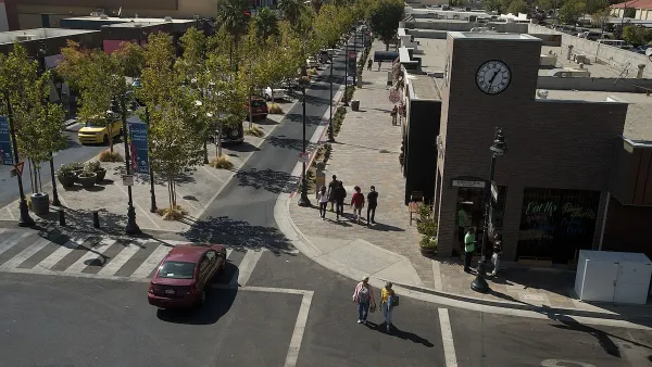
century as the distance Americans will walk before driving," calling it "a myth." In its place he proposes the use of a new tool - "Walk Appeal" - to describe walkability, which in this article he aligns with the transect. As the transect become less dense and more suburban, the comfortable walking radius actually shrinks - all the way to 25 feet along a sidewalk which runs between an arterial thoroughfare and a surface parking lot.
Future posts will look at the metrics that
determine which Walk Appeal setting a particular streetscape achieves, how Walk Appeal can predict the
viability of walkable neighborhood businesses, and the differences that Walk Appeal streetscape repairs can make in order
to cast a broader net for walking customers, writes Mouzon.
FULL STORY: Walk Appeal


Opinion: How Fire Chiefs and Traffic Engineers Make Places Less Safe
Fire standards and street design manuals, meant to protect people, actually make them less safe by damaging walkability and encouraging driving—a classic example of silo thinking.
The Vast Potential of the Right-of-Way
One writer argues that the space between two building faces is the most important element of the built environment.

Opinion: What San Francisco’s Proposed ‘Family Zoning’ Could Really Mean
Mayor Lurie is using ‘family zoning’ to encourage denser development and upzoning — but could the concept actually foster community and more human-scale public spaces?

Maui's Vacation Rental Debate Turns Ugly
Verbal attacks, misinformation campaigns and fistfights plague a high-stakes debate to convert thousands of vacation rentals into long-term housing.

Planetizen Federal Action Tracker
A weekly monitor of how Trump’s orders and actions are impacting planners and planning in America.

In Urban Planning, AI Prompting Could be the New Design Thinking
Creativity has long been key to great urban design. What if we see AI as our new creative partner?

King County Supportive Housing Program Offers Hope for Unhoused Residents
The county is taking a ‘Housing First’ approach that prioritizes getting people into housing, then offering wraparound supportive services.

Researchers Use AI to Get Clearer Picture of US Housing
Analysts are using artificial intelligence to supercharge their research by allowing them to comb through data faster. Though these AI tools can be error prone, they save time and housing researchers are optimistic about the future.

Making Shared Micromobility More Inclusive
Cities and shared mobility system operators can do more to include people with disabilities in planning and operations, per a new report.
Urban Design for Planners 1: Software Tools
This six-course series explores essential urban design concepts using open source software and equips planners with the tools they need to participate fully in the urban design process.
Planning for Universal Design
Learn the tools for implementing Universal Design in planning regulations.
planning NEXT
Appalachian Highlands Housing Partners
Mpact (founded as Rail~Volution)
City of Camden Redevelopment Agency
City of Astoria
City of Portland
City of Laramie