


For the third installment of his series on America's pedestrian problem, Tom Vanderbilt profiles Walk Score, the venerable walkability website and evaluation system.
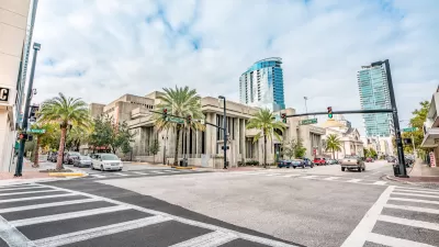
For his profile, Vanderbilt ventured to Walk Score's Seattle offices, which by the way earn a healthy, but not ideal, walk score of 80.
"Launched in 2007 as part of a series of 'civic software' initiatives, Walk Score instantly went viral, and quickly become an institution, particularly in the world of real estate. Walk Score numbers are found on every Zillow listing and on more than 10,000 realtor websites nationwide." In addition, its use has become widespread in the planning profession, where its results have become a handy metric for communicating with stakeholders.
For Vanderbilt, the most important success for the website is, "the idea that Walk Score has quantified walkability, taken an abstract quality-you know it when you see it, sort of-and turned it into something that can be measured against other addresses, other neighborhoods, even other cities (witness the New York versus San Francisco World Series of Walking). Walk Score gets people thinking concretely about walking."
"Urban planners have been talking about walkability for a long time, but it's hard to get people to pay attention," says Matt Lerner, Walk Score's CTO. "But because the scores are so personal, it's gotten people to pay attention."
FULL STORY: What’s Your Walk Score?


What the ‘Walk Score’ Misses
A popular walkability assessment omits key factors that impact different demographics and can direct development resources to already wealthy neighborhoods.
Orlando Pledges to Improve Walkability
A city report highlights successes and failures in building safer transportation infrastructure and reducing VMT in 2023.
Green Spaces Benefit Neighborhoods—When Residents can Reach Them
A study comparing green space and walkability scores found that, without effective access to local parks, residents of greener neighborhoods don’t reap the health benefits.

Maui's Vacation Rental Debate Turns Ugly
Verbal attacks, misinformation campaigns and fistfights plague a high-stakes debate to convert thousands of vacation rentals into long-term housing.

Planetizen Federal Action Tracker
A weekly monitor of how Trump’s orders and actions are impacting planners and planning in America.

San Francisco Suspends Traffic Calming Amidst Record Deaths
Citing “a challenging fiscal landscape,” the city will cease the program on the heels of 42 traffic deaths, including 24 pedestrians.

Defunct Pittsburgh Power Plant to Become Residential Tower
A decommissioned steam heat plant will be redeveloped into almost 100 affordable housing units.

Trump Prompts Restructuring of Transportation Research Board in “Unprecedented Overreach”
The TRB has eliminated more than half of its committees including those focused on climate, equity, and cities.

Amtrak Rolls Out New Orleans to Alabama “Mardi Gras” Train
The new service will operate morning and evening departures between Mobile and New Orleans.
Urban Design for Planners 1: Software Tools
This six-course series explores essential urban design concepts using open source software and equips planners with the tools they need to participate fully in the urban design process.
Planning for Universal Design
Learn the tools for implementing Universal Design in planning regulations.
Heyer Gruel & Associates PA
JM Goldson LLC
Custer County Colorado
City of Camden Redevelopment Agency
City of Astoria
Transportation Research & Education Center (TREC) at Portland State University
Jefferson Parish Government
Camden Redevelopment Agency
City of Claremont