


Unlike the nearby Bay Bridge that was built to accommodate the Key System streetcars, the Golden Gate displaced existing ferry service. Carl Nolte, the Chronicle's historian, provides the background for the 40th anniversary of its ferry service.
When the 6-county bridge district was set up, it was authorized to run only the bridge, which opened in 1937. It took an act of the state legislature to allow it to run its two transit systems -buses and ferries.
"The Golden Gate Bridge had driven the earlier San Francisco-Marin ferries out of business, and for 29 years the bridge was the only way to get from San Francisco to Sausalito.
But by the late '60s, the bridge was at capacity and consultants hired by the district recommended ferries as a short-term solution. The long-term answer, they said, was rail rapid transit under the bay to Marin.
A ferry system, the consultants said, would carry 8,000 to 11,000 daily passengers and would pay its own way.
That turned out to be a ferry tale...In the last fiscal year, the Golden Gate's Sausalito and Larkspur boats combined carried an average weekday load of 6,161 passengers. The ferries never came close to breaking even; the difference is made up by bridge tolls."
Thanks to Gladwyn d'Souza
FULL STORY: After 40 years, ferries thriving on S.F. Bay

Faced With Flocks of Tourists—Town Will Charge for Bike Parking
Sausalito will charge for bike parking, instead of limiting the number of bikes entering the city's downtown, mostly from San Francisco by biking across the Golden Gate bridge and often taking a Golden Gate ferry back.
Bay Area Commuters Clamor for More Ferry Service
Several days a week dissatisfied patrons are left behind when full boats depart the Larkspur Ferry Terminal in Marin County. More ferries to SF are planned, as are new parking fees at the terminal and shuttle service for those who forgo driving.
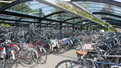
Unappreciated Cyclists In Sausalito
Marin County has a reputation to live up to. In this column, Sausalito does just that in its treatment of hordes of cycling tourists who rent bikes on Fisherman's Wharf, pedal across the GG Bridge to have lunch in Sausalito, and return on the ferry.

Maui's Vacation Rental Debate Turns Ugly
Verbal attacks, misinformation campaigns and fistfights plague a high-stakes debate to convert thousands of vacation rentals into long-term housing.

Planetizen Federal Action Tracker
A weekly monitor of how Trump’s orders and actions are impacting planners and planning in America.

In Urban Planning, AI Prompting Could be the New Design Thinking
Creativity has long been key to great urban design. What if we see AI as our new creative partner?

King County Supportive Housing Program Offers Hope for Unhoused Residents
The county is taking a ‘Housing First’ approach that prioritizes getting people into housing, then offering wraparound supportive services.

Researchers Use AI to Get Clearer Picture of US Housing
Analysts are using artificial intelligence to supercharge their research by allowing them to comb through data faster. Though these AI tools can be error prone, they save time and housing researchers are optimistic about the future.

Making Shared Micromobility More Inclusive
Cities and shared mobility system operators can do more to include people with disabilities in planning and operations, per a new report.
Urban Design for Planners 1: Software Tools
This six-course series explores essential urban design concepts using open source software and equips planners with the tools they need to participate fully in the urban design process.
Planning for Universal Design
Learn the tools for implementing Universal Design in planning regulations.
planning NEXT
Appalachian Highlands Housing Partners
Mpact (founded as Rail~Volution)
City of Camden Redevelopment Agency
City of Astoria
City of Portland
City of Laramie