


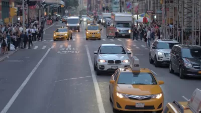
A preliminary count of all road fatalities in 2009 shows a record low figure of 33,963; almost 9% lower than 2008. The final count is due this summer. While the declining VMT due to a depressed economy was a major factor, the rate declined as well.
It's the lowest level since 1954, while the rate (deaths per 100 million miles traveled) is the lowest ever. The Times offers some explanations for the falling numbers.
"The fatality rate, which takes into account the number of miles traveled, was 1.16 deaths for every 100 million vehicle miles traveled in 2009, based on statistical projections of early data collected by the National Highway Traffic Safety Administration.
The agency attributes the recent decline to a combination of factors, including nationwide campaigns aimed to increase seat belt use and to prevent drunken and distracted driving, and safer roads and vehicles. The agency also noted that people are driving less.
Mr. Kissinger said more analysis of the data was needed, but that most experts agreed that the recent downturn in the economy played a role. He said that better enforcement, more effective laws, like those that govern teenage driving, and improved technology, like electronic stability control, have also contributed to the lower death rate."
Thanks to Streetsblog Daily
FULL STORY: Traffic Fatalities Drop to Record Low

Despite Reports, Federal Safety Officials Didn't Act on Danger of SUVs to Pedestrians
A 2015 NHTSA report showed that pedestrians were multiple times more likely to die if struck by SUVs, but that information was neither shared nor acted upon.
Automotive Braking Improvements: Pedestrian and Cyclist Benefits Included
NHTSA's announcement that automatic emergency braking will become standard on almost all new vehicles by 2022 will have dramatic safety implications for drivers and passengers, but will it prevent crashes with pedestrians and cyclists?
Federal Report Finds Increasing Numbers of Traffic Deaths
With more driving comes a lot more deaths on the nation's roads. The question is why traffic deaths increase at a greater rate than vehicle miles traveled.

Montreal Mall to Become 6,000 Housing Units
Place Versailles will be transformed into a mixed-use complex over the next 25 years.

Planetizen Federal Action Tracker
A weekly monitor of how Trump’s orders and actions are impacting planners and planning in America.

DARTSpace Platform Streamlines Dallas TOD Application Process
The Dallas transit agency hopes a shorter permitting timeline will boost transit-oriented development around rail stations.

Interactive Map Reveals America's “Shade Deserts”
Launched by UCLA and American Forests to combat heat-related deaths, the tool maps the shade infrastructure for over 360 U.S. cities.

Bicycles and Books — In Sacramento, Libraries Now Offer Both
Adult library card holders can check out e-bikes and e-trikes for up to one week.

Colorado Landfills Emit as Much Pollution as 1M Cars
Landfills are the third-largest source of methane pollution in Colorado, after agriculture and fossil fuel extraction.
Urban Design for Planners 1: Software Tools
This six-course series explores essential urban design concepts using open source software and equips planners with the tools they need to participate fully in the urban design process.
Planning for Universal Design
Learn the tools for implementing Universal Design in planning regulations.
City of Mt Shasta
City of Camden Redevelopment Agency
City of Astoria
Transportation Research & Education Center (TREC) at Portland State University
City of Camden Redevelopment Agency
Municipality of Princeton (NJ)
Regional Transportation Commission of Southern Nevada