


Planning policies that produce cheap, abundant parking are fundamentally at odds with efforts to promote transit, biking, and walking. A new report from ITDP shows how some cities have started to align parking policies with sustainable transport.
It's been more than 35 years since American cities including New York, Boston, and Portland acknowledged the connection between parking policy and traffic generation by setting limits on downtown parking. Since then, parking innovation has proceeded at a snail's pace. Streetsblog reports on a new study that highlights how that's starting to change:
"In San Francisco and New York, programs to bring the price of curbside parking more in line with off-street parking are reducing the incentive to cruise endlessly for a cheap spot. In Portland, planners have reduced parking requirements for new development near transit lines, helping to improve walkability and increase ridership.
"Boulder provides an intriguing study in parking management as an economic development tool. This small Colorado city is one of the only places that introduced new parking policies during the 80s and 90s. After deciding they couldn't compete with suburban malls by imitating them, local merchants led an effort that effectively capped the volume of downtown parking and directed revenue from parking facilities to improve transit, walking, and bicycling."
FULL STORY: Want to Foster Walking, Biking and Transit? You Need Good Parking Policy


Watch: How to Remove Thousands of Parking Spaces
What the city of Amsterdam will gain by removing cars from on-street parking space.
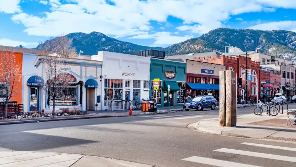
Boulder Eliminates Parking Minimums Citywide
Officials estimate the cost of building a single underground parking space at up to $100,000.
Santa Monica May Raise Parking Permit Fees
The city says the changes would help better manage curb space and support its sustainability goals.

Maui's Vacation Rental Debate Turns Ugly
Verbal attacks, misinformation campaigns and fistfights plague a high-stakes debate to convert thousands of vacation rentals into long-term housing.

Planetizen Federal Action Tracker
A weekly monitor of how Trump’s orders and actions are impacting planners and planning in America.

San Francisco Suspends Traffic Calming Amidst Record Deaths
Citing “a challenging fiscal landscape,” the city will cease the program on the heels of 42 traffic deaths, including 24 pedestrians.

Defunct Pittsburgh Power Plant to Become Residential Tower
A decommissioned steam heat plant will be redeveloped into almost 100 affordable housing units.

Trump Prompts Restructuring of Transportation Research Board in “Unprecedented Overreach”
The TRB has eliminated more than half of its committees including those focused on climate, equity, and cities.

Amtrak Rolls Out New Orleans to Alabama “Mardi Gras” Train
The new service will operate morning and evening departures between Mobile and New Orleans.
Urban Design for Planners 1: Software Tools
This six-course series explores essential urban design concepts using open source software and equips planners with the tools they need to participate fully in the urban design process.
Planning for Universal Design
Learn the tools for implementing Universal Design in planning regulations.
Heyer Gruel & Associates PA
JM Goldson LLC
Custer County Colorado
City of Camden Redevelopment Agency
City of Astoria
Transportation Research & Education Center (TREC) at Portland State University
Jefferson Parish Government
Camden Redevelopment Agency
City of Claremont