


NASA satellite imagery reveals that two of California's main groundwater sources are being rapidly depleted by agriculture and exurban development.
"The measurements show the amount of water lost in the two main Central Valley river basins within the past six years could almost fill the nation's largest reservoir, Lake Mead in Nevada.
"All that water has been sucked from these river basins. It's gone. It's left the building," says Jay Famiglietti, an earth science professor at the University of California, Irvine, who led the research collaboration. "The data is telling us that this rate of pumping is not sustainable."
Hundreds of farmers have been drilling wells to irrigate their crops, as three years of drought and environmental restrictions on water supplies have withered crops, jobs and profits throughout the San Joaquin Valley, where roughly half of the nation's fruits, nuts, and vegetables are grown."
NASA researchers say that more than three-quarters of the groundwater loss is due to agricultural irrigation.
FULL STORY: California's groundwater shrinking because of agricultural use


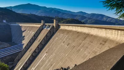
Voters to Decide on Repair of Vital Aqueduct for San Joaquin Valley
California voters in November will have the opportunity to help repair the Friant-Kern Canal, damaged by subsidence, as well as invest in watershed conservation programs, by passing a citizen-initiated $8.9 billion general obligation bond measure.
Why Are the Feds Suddenly in Favor of Raising the Shasta Dam?
Despite state opposition and potential violations of California law, the Trump Administration has revived a project that was deemed impracticable only a few years ago.
The Incredible Sinking Central Valley
Parts of the nation's food basket, the San Joaquin Valley in California, are sinking at two inches per month, not per year. Known as subsidence, it results from over-pumping of groundwater by farmers desperate to save their crops in the epic drought.

Planetizen Federal Action Tracker
A weekly monitor of how Trump’s orders and actions are impacting planners and planning in America.

Chicago’s Ghost Rails
Just beneath the surface of the modern city lie the remnants of its expansive early 20th-century streetcar system.

San Antonio and Austin are Fusing Into one Massive Megaregion
The region spanning the two central Texas cities is growing fast, posing challenges for local infrastructure and water supplies.

Since Zion's Shuttles Went Electric “The Smog is Gone”
Visitors to Zion National Park can enjoy the canyon via the nation’s first fully electric park shuttle system.

Trump Distributing DOT Safety Funds at 1/10 Rate of Biden
Funds for Safe Streets and other transportation safety and equity programs are being held up by administrative reviews and conflicts with the Trump administration’s priorities.

German Cities Subsidize Taxis for Women Amid Wave of Violence
Free or low-cost taxi rides can help women navigate cities more safely, but critics say the programs don't address the root causes of violence against women.
Urban Design for Planners 1: Software Tools
This six-course series explores essential urban design concepts using open source software and equips planners with the tools they need to participate fully in the urban design process.
Planning for Universal Design
Learn the tools for implementing Universal Design in planning regulations.
planning NEXT
Appalachian Highlands Housing Partners
Mpact (founded as Rail~Volution)
City of Camden Redevelopment Agency
City of Astoria
City of Portland
City of Laramie