


The American Society of Landscape Architects interviews Sandra James, City and Greenways Planner with the City of Vancouver, about her city's innovative practices.
"James explains how Vancouver defines a green street: 'For the city of Vancouver, a green street is really a street where walking and biking is prioritized ahead of cars. In 1992, we were a bit ahead of the curve - a group of landscape architects and people who were genuinely interested in the walking environment formed an Urban Landscape Taskforce and looked at designing a system of streets that went border to border, called 'greenways.' These streets have sidewalks, pedestrian ramps at each corner of the sidewalk, pedestrian activated intersection controls where needed, infiltration bulges, way finding, public plantings, benches, water fountains and public art. But, functionally, they really are called green streets in any other part of the country or in North America.'"
FULL STORY: Interview with Sandra James on Vancouver’s Green Streets

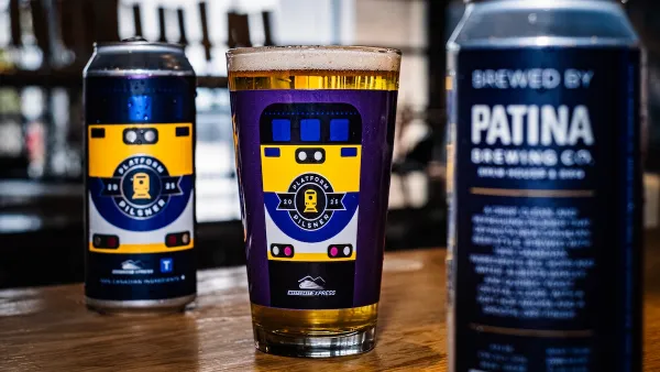
Platform Pilsner: Vancouver Transit Agency Releases... a Beer?
TransLink will receive a portion of every sale of the four-pack.
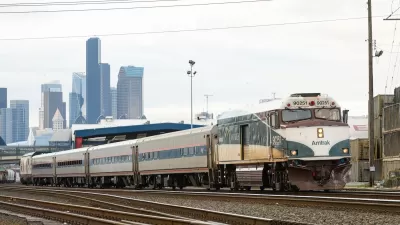
Amtrak Cascades Line Breaks Ridership Record
The route linking Portland, Seattle, and Vancouver, BC served nearly one million riders in 2024.
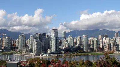
Vancouver City Council Eliminates Parking Mandates, Supports TOD
In a significant step for more diverse housing and transit-friendly development, the Vancouver City Council eliminated parking minimums and adopted a Transit-Oriented Areas (TOA) policy.

Planetizen Federal Action Tracker
A weekly monitor of how Trump’s orders and actions are impacting planners and planning in America.

Restaurant Patios Were a Pandemic Win — Why Were They so Hard to Keep?
Social distancing requirements and changes in travel patterns prompted cities to pilot new uses for street and sidewalk space. Then it got complicated.

Map: Where Senate Republicans Want to Sell Your Public Lands
For public land advocates, the Senate Republicans’ proposal to sell millions of acres of public land in the West is “the biggest fight of their careers.”

Maui's Vacation Rental Debate Turns Ugly
Verbal attacks, misinformation campaigns and fistfights plague a high-stakes debate to convert thousands of vacation rentals into long-term housing.

San Francisco Suspends Traffic Calming Amidst Record Deaths
Citing “a challenging fiscal landscape,” the city will cease the program on the heels of 42 traffic deaths, including 24 pedestrians.

California Homeless Arrests, Citations Spike After Ruling
An investigation reveals that anti-homeless actions increased up to 500% after Grants Pass v. Johnson — even in cities claiming no policy change.
Urban Design for Planners 1: Software Tools
This six-course series explores essential urban design concepts using open source software and equips planners with the tools they need to participate fully in the urban design process.
Planning for Universal Design
Learn the tools for implementing Universal Design in planning regulations.
Heyer Gruel & Associates PA
JM Goldson LLC
Custer County Colorado
City of Camden Redevelopment Agency
City of Astoria
Transportation Research & Education Center (TREC) at Portland State University
Camden Redevelopment Agency
City of Claremont
Municipality of Princeton (NJ)